
V49A McMinnville, TN, USA - Earthquake Result Viewer
| ||||||||||||||||||
| ||||||||||||||||||
| ||||||||||||||||||
|
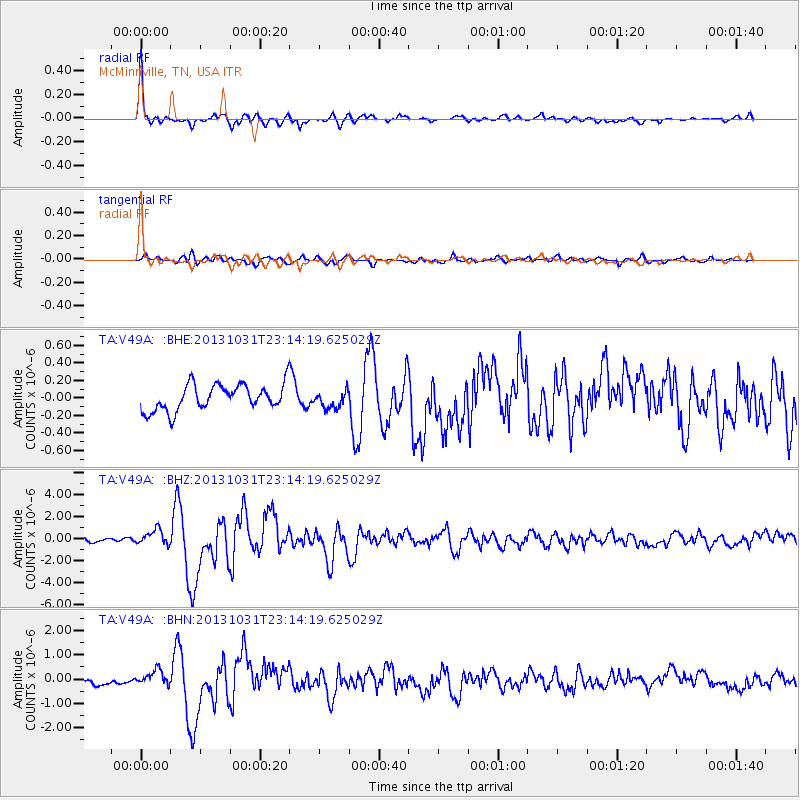
Signal To Noise
| Channel | StoN | STA | LTA |
| TA:V49A: :BHZ:20131031T23:14:19.625029Z | 3.448806 | 6.908052E-7 | 2.0030272E-7 |
| TA:V49A: :BHN:20131031T23:14:19.625029Z | 2.5434003 | 3.1677672E-7 | 1.245485E-7 |
| TA:V49A: :BHE:20131031T23:14:19.625029Z | 0.66730744 | 9.870808E-8 | 1.4791993E-7 |
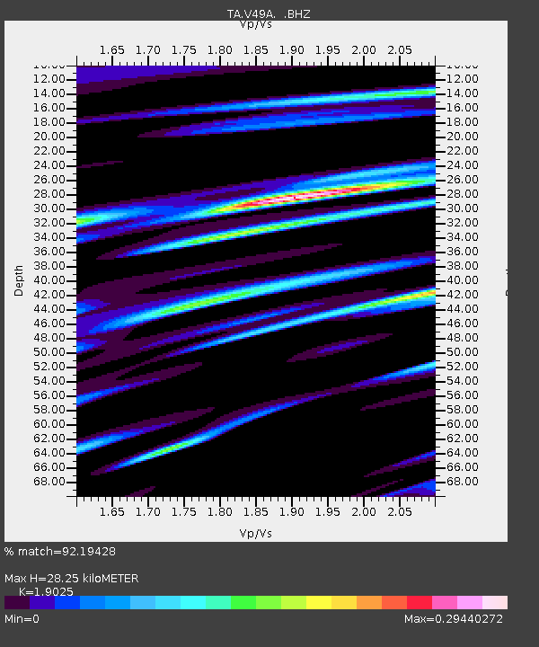
| Arrivals | |
| Ps | 4.2 SECOND |
| PpPs | 12 SECOND |
| PsPs/PpSs | 17 SECOND |

