V53A Saluda, NC, USA - Earthquake Result Viewer
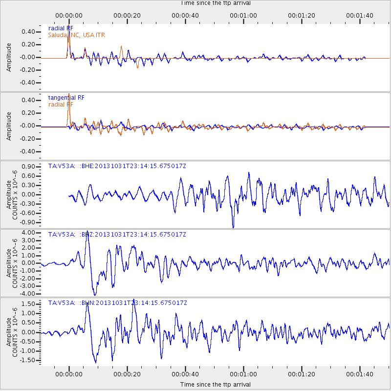
Earthquake location: Near Coast Of Central Chile
Earthquake latitude/longitude: -30.3/-71.5
Earthquake time(UTC): 2013/10/31 (304) 23:03:59 GMT
Earthquake Depth: 27 km
Earthquake Magnitude: 6.6 MWW, 6.4 MWB, 6.5 MWC, 6.6 MWW, 6.6 MI
Earthquake Catalog/Contributor: NEIC PDE/NEIC COMCAT
Network: TA USArray Transportable Network (new EarthScope stations)
Station: V53A Saluda, NC, USA
Lat/Lon: 35.67 N/82.81 W
Elevation: 681 m
Distance: 66.5 deg
Az: 349.986 deg
Baz: 169.356 deg
Ray Param: 0.05755959
Estimated Moho Depth: 50.75 km
Estimated Crust Vp/Vs: 1.66
Assumed Crust Vp: 6.35 km/s
Estimated Crust Vs: 3.82 km/s
Estimated Crust Poisson's Ratio: 0.22
Radial Match: 91.786156 %
Radial Bump: 400
Transverse Match: 79.55217 %
Transverse Bump: 400
SOD ConfigId: 626651
Insert Time: 2014-04-19 09:23:08.338 +0000
GWidth: 2.5
Max Bumps: 400
Tol: 0.001

Signal To Noise

ChannelStoNSTALTA
TA:V53A: :BHZ:20131031T23:14:15.675017Z4.6296146.699588E-71.4471159E-7
TA:V53A: :BHN:20131031T23:14:15.675017Z1.49050811.7484288E-71.17304225E-7
TA:V53A: :BHE:20131031T23:14:15.675017Z0.73815739.3873304E-81.271725E-7
Arrivals
Ps5.5 SECOND
PpPs20 SECOND
PsPs/PpSs26 SECOND