V54A Nebo, NC, USA - Earthquake Result Viewer
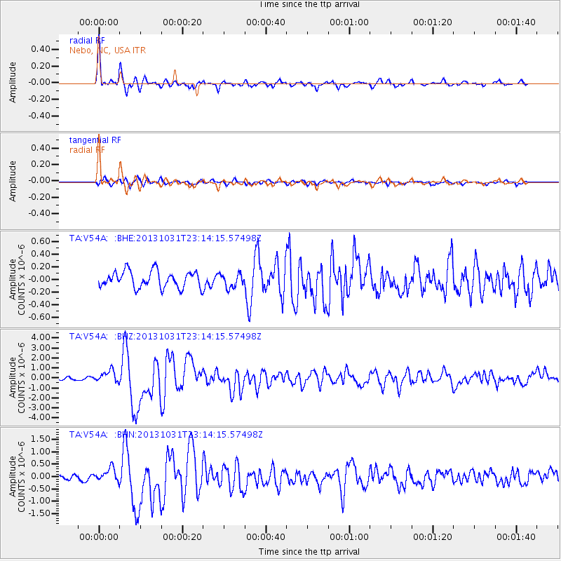
Earthquake location: Near Coast Of Central Chile
Earthquake latitude/longitude: -30.3/-71.5
Earthquake time(UTC): 2013/10/31 (304) 23:03:59 GMT
Earthquake Depth: 27 km
Earthquake Magnitude: 6.6 MWW, 6.4 MWB, 6.5 MWC, 6.6 MWW, 6.6 MI
Earthquake Catalog/Contributor: NEIC PDE/NEIC COMCAT
Network: TA USArray Transportable Network (new EarthScope stations)
Station: V54A Nebo, NC, USA
Lat/Lon: 35.78 N/81.95 W
Elevation: 448 m
Distance: 66.4 deg
Az: 350.762 deg
Baz: 170.168 deg
Ray Param: 0.057572436
Estimated Moho Depth: 44.75 km
Estimated Crust Vp/Vs: 1.70
Assumed Crust Vp: 6.419 km/s
Estimated Crust Vs: 3.776 km/s
Estimated Crust Poisson's Ratio: 0.24
Radial Match: 94.84432 %
Radial Bump: 322
Transverse Match: 81.27274 %
Transverse Bump: 400
SOD ConfigId: 626651
Insert Time: 2014-04-19 09:23:10.026 +0000
GWidth: 2.5
Max Bumps: 400
Tol: 0.001

Signal To Noise

ChannelStoNSTALTA
TA:V54A: :BHZ:20131031T23:14:15.57498Z4.38646366.120036E-71.3952095E-7
TA:V54A: :BHN:20131031T23:14:15.57498Z2.93223052.7005373E-79.2098404E-8
TA:V54A: :BHE:20131031T23:14:15.57498Z0.85589121.1186968E-71.3070549E-7
Arrivals
Ps5.1 SECOND
PpPs18 SECOND
PsPs/PpSs23 SECOND