
V56A Mocksville, NC, USA - Earthquake Result Viewer
| ||||||||||||||||||
| ||||||||||||||||||
| ||||||||||||||||||
|
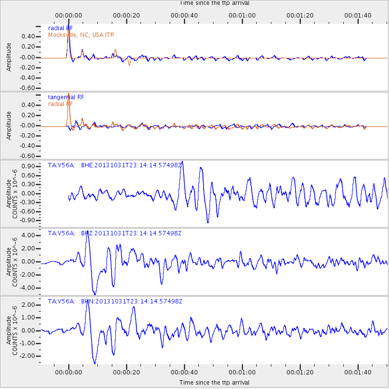
Signal To Noise
| Channel | StoN | STA | LTA |
| TA:V56A: :BHZ:20131031T23:14:14.57498Z | 3.413924 | 6.460998E-7 | 1.892543E-7 |
| TA:V56A: :BHN:20131031T23:14:14.57498Z | 2.6600666 | 3.0054363E-7 | 1.129835E-7 |
| TA:V56A: :BHE:20131031T23:14:14.57498Z | 0.9880067 | 1.0585259E-7 | 1.07137524E-7 |
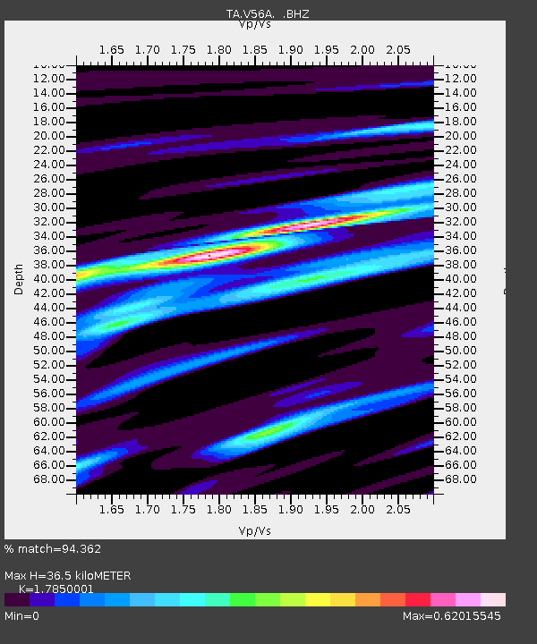
| Arrivals | |
| Ps | 4.6 SECOND |
| PpPs | 15 SECOND |
| PsPs/PpSs | 20 SECOND |

