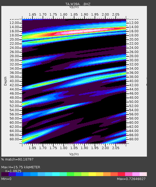
W39A Magazine, AR, USA - Earthquake Result Viewer
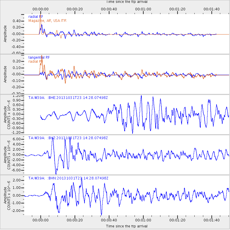
Earthquake location: Near Coast Of Central Chile
Earthquake latitude/longitude: -30.3/-71.5
Earthquake time(UTC): 2013/10/31 (304) 23:03:59 GMT
Earthquake Depth: 27 km
Earthquake Magnitude: 6.6 MWW, 6.4 MWB, 6.5 MWC, 6.6 MWW, 6.6 MI
Earthquake Catalog/Contributor: NEIC PDE/NEIC COMCAT
Network: TA USArray Transportable Network (new EarthScope stations)
Station: W39A Magazine, AR, USA
Lat/Lon: 35.20 N/93.78 W
Elevation: 162 m
Distance: 68.4 deg
Az: 340.51 deg
Baz: 159.369 deg
Ray Param: 0.05627093
Estimated Moho Depth: 15.75 km
Estimated Crust Vp/Vs: 1.89
Assumed Crust Vp: 6.498 km/s
Estimated Crust Vs: 3.433 km/s
Estimated Crust Poisson's Ratio: 0.31
Radial Match: 90.18797 %
Radial Bump: 400
Transverse Match: 80.43691 %
Transverse Bump: 400
SOD ConfigId: 626651
Insert Time: 2014-04-19 09:23:30.380 +0000
GWidth: 2.5
Max Bumps: 400
Tol: 0.001

Signal To Noise

ChannelStoNSTALTA
TA:W39A: :BHZ:20131031T23:14:28.07498Z2.6840677.6098183E-72.835182E-7
TA:W39A: :BHN:20131031T23:14:28.07498Z1.7062992.6247056E-71.5382449E-7
TA:W39A: :BHE:20131031T23:14:28.07498Z1.38110472.1573089E-71.562017E-7
Arrivals
Ps2.2 SECOND
PpPs6.8 SECOND
PsPs/PpSs9.0 SECOND