W50A Signal Mountain, TN, USA - Earthquake Result Viewer
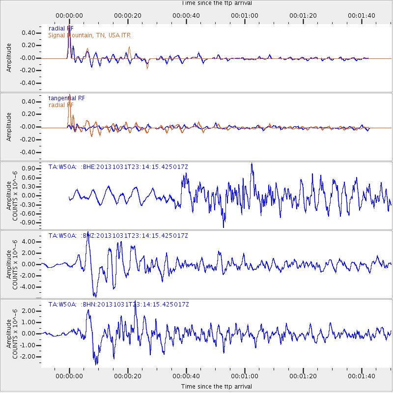
Earthquake location: Near Coast Of Central Chile
Earthquake latitude/longitude: -30.3/-71.5
Earthquake time(UTC): 2013/10/31 (304) 23:03:59 GMT
Earthquake Depth: 27 km
Earthquake Magnitude: 6.6 MWW, 6.4 MWB, 6.5 MWC, 6.6 MWW, 6.6 MI
Earthquake Catalog/Contributor: NEIC PDE/NEIC COMCAT
Network: TA USArray Transportable Network (new EarthScope stations)
Station: W50A Signal Mountain, TN, USA
Lat/Lon: 35.20 N/85.31 W
Elevation: 587 m
Distance: 66.4 deg
Az: 347.702 deg
Baz: 167.0 deg
Ray Param: 0.05758609
Estimated Moho Depth: 16.0 km
Estimated Crust Vp/Vs: 1.60
Assumed Crust Vp: 6.35 km/s
Estimated Crust Vs: 3.969 km/s
Estimated Crust Poisson's Ratio: 0.18
Radial Match: 92.86041 %
Radial Bump: 400
Transverse Match: 74.91586 %
Transverse Bump: 400
SOD ConfigId: 626651
Insert Time: 2014-04-19 09:23:39.596 +0000
GWidth: 2.5
Max Bumps: 400
Tol: 0.001

Signal To Noise

ChannelStoNSTALTA
TA:W50A: :BHZ:20131031T23:14:15.425017Z3.15779147.8054734E-72.4718142E-7
TA:W50A: :BHN:20131031T23:14:15.425017Z2.11958272.8458655E-71.3426536E-7
TA:W50A: :BHE:20131031T23:14:15.425017Z0.62194129.8943374E-81.5908799E-7
Arrivals
Ps1.6 SECOND
PpPs6.3 SECOND
PsPs/PpSs7.8 SECOND