
W53A Cullowhee, NC, USA - Earthquake Result Viewer
| ||||||||||||||||||
| ||||||||||||||||||
| ||||||||||||||||||
|
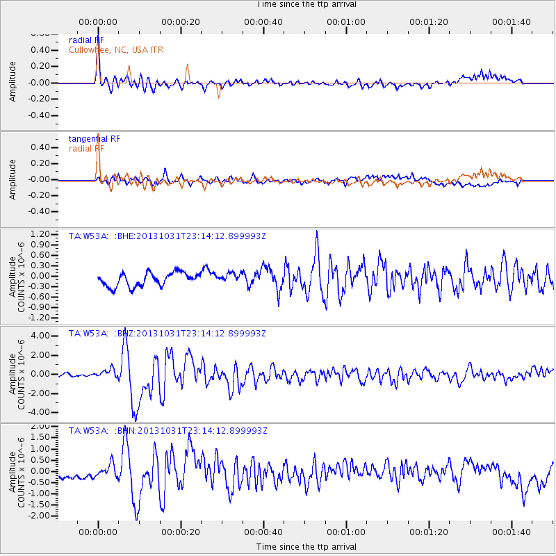
Signal To Noise
| Channel | StoN | STA | LTA |
| TA:W53A: :BHZ:20131031T23:14:12.899993Z | 3.0752451 | 4.940209E-7 | 1.6064439E-7 |
| TA:W53A: :BHN:20131031T23:14:12.899993Z | 1.5429724 | 2.8496646E-7 | 1.8468667E-7 |
| TA:W53A: :BHE:20131031T23:14:12.899993Z | 0.7733501 | 1.480417E-7 | 1.9142908E-7 |
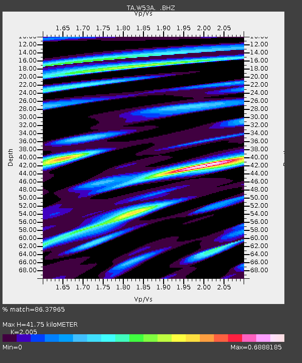
| Arrivals | |
| Ps | 6.8 SECOND |
| PpPs | 19 SECOND |
| PsPs/PpSs | 26 SECOND |

