
W57A Gilead, NC, USA - Earthquake Result Viewer
| ||||||||||||||||||
| ||||||||||||||||||
| ||||||||||||||||||
|
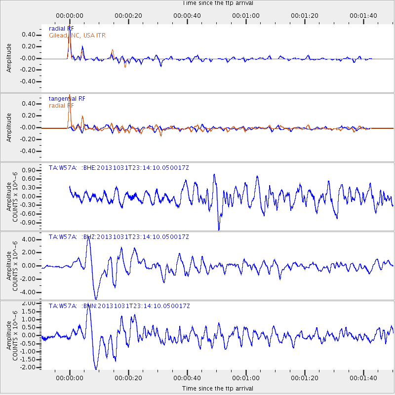
Signal To Noise
| Channel | StoN | STA | LTA |
| TA:W57A: :BHZ:20131031T23:14:10.050017Z | 4.7809434 | 6.3598475E-7 | 1.3302495E-7 |
| TA:W57A: :BHN:20131031T23:14:10.050017Z | 2.7335658 | 2.9956897E-7 | 1.0958908E-7 |
| TA:W57A: :BHE:20131031T23:14:10.050017Z | 0.85306865 | 1.2169356E-7 | 1.426539E-7 |
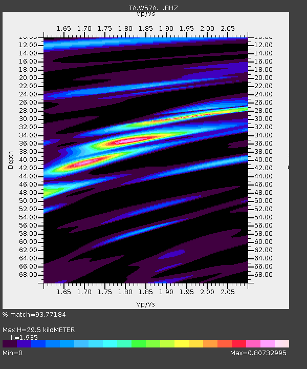
| Arrivals | |
| Ps | 4.4 SECOND |
| PpPs | 13 SECOND |
| PsPs/PpSs | 17 SECOND |

