
W58A Raeford, NC, USA - Earthquake Result Viewer
| ||||||||||||||||||
| ||||||||||||||||||
| ||||||||||||||||||
|
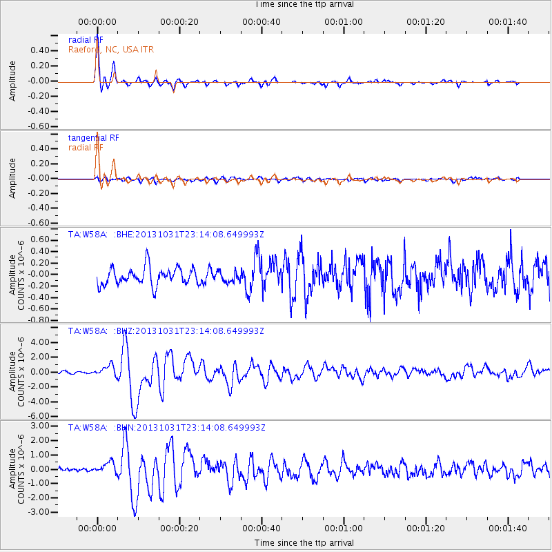
Signal To Noise
| Channel | StoN | STA | LTA |
| TA:W58A: :BHZ:20131031T23:14:08.649993Z | 4.1981626 | 7.491438E-7 | 1.7844565E-7 |
| TA:W58A: :BHN:20131031T23:14:08.649993Z | 3.2155697 | 4.0742714E-7 | 1.2670449E-7 |
| TA:W58A: :BHE:20131031T23:14:08.649993Z | 0.5974901 | 9.020425E-8 | 1.5097196E-7 |
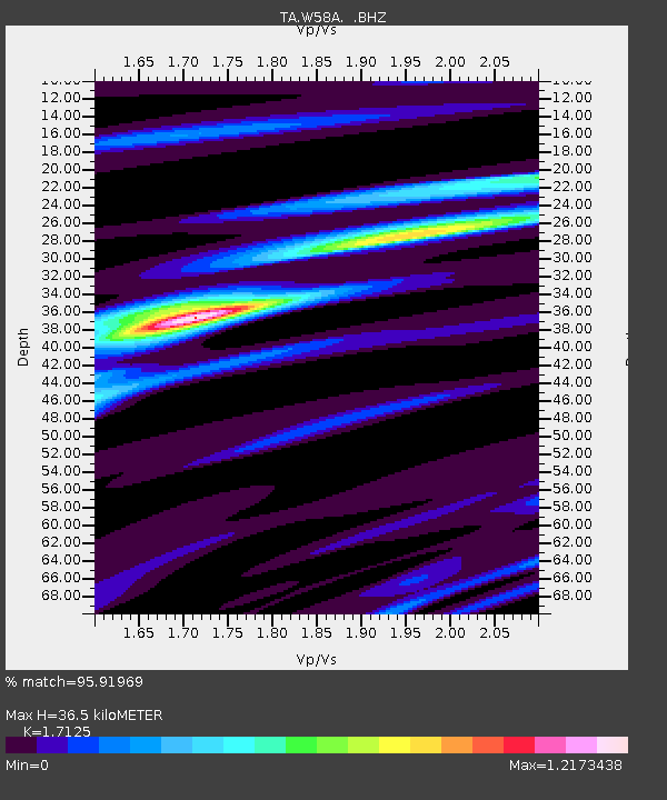
| Arrivals | |
| Ps | 4.1 SECOND |
| PpPs | 14 SECOND |
| PsPs/PpSs | 19 SECOND |

