W59A Clinton, NC, USA - Earthquake Result Viewer
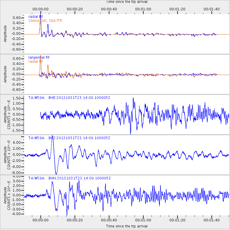
Earthquake location: Near Coast Of Central Chile
Earthquake latitude/longitude: -30.3/-71.5
Earthquake time(UTC): 2013/10/31 (304) 23:03:59 GMT
Earthquake Depth: 27 km
Earthquake Magnitude: 6.6 MWW, 6.4 MWB, 6.5 MWC, 6.6 MWW, 6.6 MI
Earthquake Catalog/Contributor: NEIC PDE/NEIC COMCAT
Network: TA USArray Transportable Network (new EarthScope stations)
Station: W59A Clinton, NC, USA
Lat/Lon: 35.17 N/78.44 W
Elevation: 60 m
Distance: 65.4 deg
Az: 353.768 deg
Baz: 173.419 deg
Ray Param: 0.058234297
Estimated Moho Depth: 37.75 km
Estimated Crust Vp/Vs: 1.72
Assumed Crust Vp: 6.565 km/s
Estimated Crust Vs: 3.822 km/s
Estimated Crust Poisson's Ratio: 0.24
Radial Match: 94.19362 %
Radial Bump: 400
Transverse Match: 82.88066 %
Transverse Bump: 400
SOD ConfigId: 626651
Insert Time: 2014-04-19 09:23:58.340 +0000
GWidth: 2.5
Max Bumps: 400
Tol: 0.001

Signal To Noise

ChannelStoNSTALTA
TA:W59A: :BHZ:20131031T23:14:09.100005Z4.79646258.33377E-71.7374825E-7
TA:W59A: :BHN:20131031T23:14:09.100005Z2.5066934.328179E-71.726649E-7
TA:W59A: :BHE:20131031T23:14:09.100005Z1.12303211.997112E-71.7783215E-7
Arrivals
Ps4.3 SECOND
PpPs15 SECOND
PsPs/PpSs19 SECOND