X53A Estanollee, GA, USA - Earthquake Result Viewer
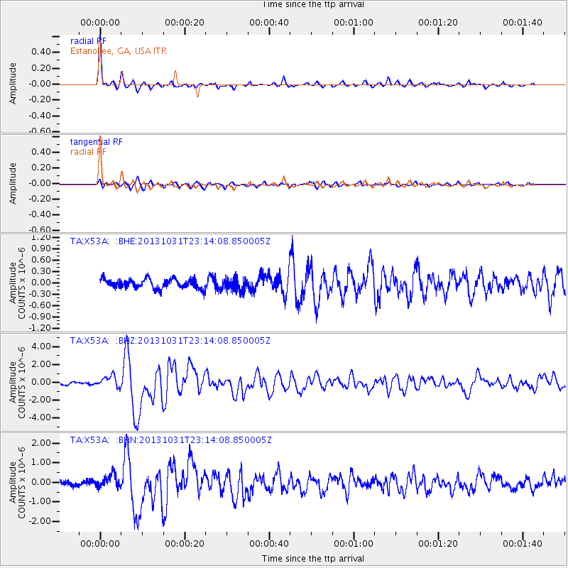
Earthquake location: Near Coast Of Central Chile
Earthquake latitude/longitude: -30.3/-71.5
Earthquake time(UTC): 2013/10/31 (304) 23:03:59 GMT
Earthquake Depth: 27 km
Earthquake Magnitude: 6.6 MWW, 6.4 MWB, 6.5 MWC, 6.6 MWW, 6.6 MI
Earthquake Catalog/Contributor: NEIC PDE/NEIC COMCAT
Network: TA USArray Transportable Network (new EarthScope stations)
Station: X53A Estanollee, GA, USA
Lat/Lon: 34.50 N/83.30 W
Elevation: 240 m
Distance: 65.4 deg
Az: 349.314 deg
Baz: 168.802 deg
Ray Param: 0.058258407
Estimated Moho Depth: 28.75 km
Estimated Crust Vp/Vs: 2.10
Assumed Crust Vp: 6.35 km/s
Estimated Crust Vs: 3.027 km/s
Estimated Crust Poisson's Ratio: 0.35
Radial Match: 91.646645 %
Radial Bump: 326
Transverse Match: 79.91322 %
Transverse Bump: 400
SOD ConfigId: 626651
Insert Time: 2014-04-19 09:24:18.186 +0000
GWidth: 2.5
Max Bumps: 400
Tol: 0.001

Signal To Noise

ChannelStoNSTALTA
TA:X53A: :BHZ:20131031T23:14:08.850005Z5.04846056.544225E-71.2962813E-7
TA:X53A: :BHN:20131031T23:14:08.850005Z2.66096693.5551545E-71.3360386E-7
TA:X53A: :BHE:20131031T23:14:08.850005Z1.39262331.7365495E-71.2469629E-7
Arrivals
Ps5.1 SECOND
PpPs14 SECOND
PsPs/PpSs19 SECOND