
Y52A Lilburn, GA, USA - Earthquake Result Viewer
| ||||||||||||||||||
| ||||||||||||||||||
| ||||||||||||||||||
|
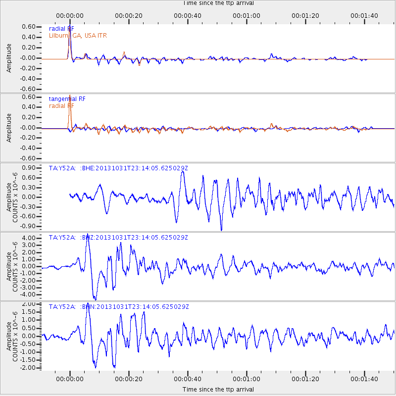
Signal To Noise
| Channel | StoN | STA | LTA |
| TA:Y52A: :BHZ:20131031T23:14:05.625029Z | 5.217187 | 5.8224146E-7 | 1.1160064E-7 |
| TA:Y52A: :BHN:20131031T23:14:05.625029Z | 3.2996233 | 3.4741132E-7 | 1.0528818E-7 |
| TA:Y52A: :BHE:20131031T23:14:05.625029Z | 0.78543085 | 1.2142885E-7 | 1.5460158E-7 |
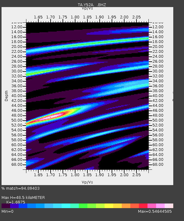
| Arrivals | |
| Ps | 5.3 SECOND |
| PpPs | 19 SECOND |
| PsPs/PpSs | 24 SECOND |

