Y54A Tignall, GA, USA - Earthquake Result Viewer
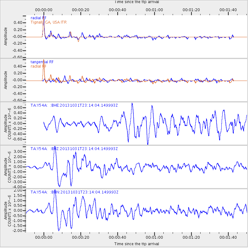
Earthquake location: Near Coast Of Central Chile
Earthquake latitude/longitude: -30.3/-71.5
Earthquake time(UTC): 2013/10/31 (304) 23:03:59 GMT
Earthquake Depth: 27 km
Earthquake Magnitude: 6.6 MWW, 6.4 MWB, 6.5 MWC, 6.6 MWW, 6.6 MI
Earthquake Catalog/Contributor: NEIC PDE/NEIC COMCAT
Network: TA USArray Transportable Network (new EarthScope stations)
Station: Y54A Tignall, GA, USA
Lat/Lon: 33.86 N/82.69 W
Elevation: 176 m
Distance: 64.7 deg
Az: 349.73 deg
Baz: 169.321 deg
Ray Param: 0.058731966
Estimated Moho Depth: 36.75 km
Estimated Crust Vp/Vs: 1.70
Assumed Crust Vp: 6.565 km/s
Estimated Crust Vs: 3.873 km/s
Estimated Crust Poisson's Ratio: 0.23
Radial Match: 93.051025 %
Radial Bump: 323
Transverse Match: 84.83296 %
Transverse Bump: 400
SOD ConfigId: 626651
Insert Time: 2014-04-19 09:24:47.443 +0000
GWidth: 2.5
Max Bumps: 400
Tol: 0.001

Signal To Noise

ChannelStoNSTALTA
TA:Y54A: :BHZ:20131031T23:14:04.149993Z2.6185375.679428E-72.1689317E-7
TA:Y54A: :BHN:20131031T23:14:04.149993Z2.69899583.6729182E-71.3608461E-7
TA:Y54A: :BHE:20131031T23:14:04.149993Z1.59232161.7996655E-71.13021486E-7
Arrivals
Ps4.1 SECOND
PpPs14 SECOND
PsPs/PpSs18 SECOND