
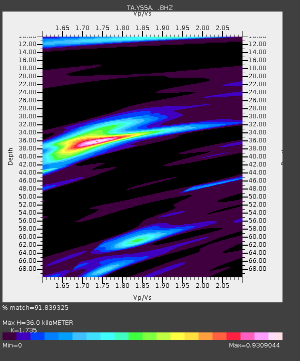
Y55A Saluda, SC, USA - Earthquake Result Viewer
| ||||||||||||||||||
| ||||||||||||||||||
| ||||||||||||||||||
|
Signal To Noise
| Channel | StoN | STA | LTA |
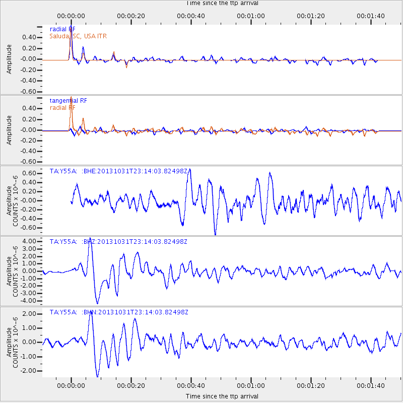
| TA:Y55A: :BHZ:20131031T23:14:03.82498Z | 4.1655054 | 5.48454E-7 | 1.3166566E-7 |
| TA:Y55A: :BHN:20131031T23:14:03.82498Z | 1.7485483 | 2.5202175E-7 | 1.44132E-7 |
| TA:Y55A: :BHE:20131031T23:14:03.82498Z | 0.7718867 | 9.480136E-8 | 1.2281772E-7 |
| Arrivals | |
| Ps | 4.2 SECOND |
| PpPs | 14 SECOND |
| PsPs/PpSs | 19 SECOND |

