You are here: Home > Network List > AV - Alaska Volcano Observatory Stations List
> Station SPCR Ckakachatna River, Mount Spurr, Alaska > Earthquake Result Viewer
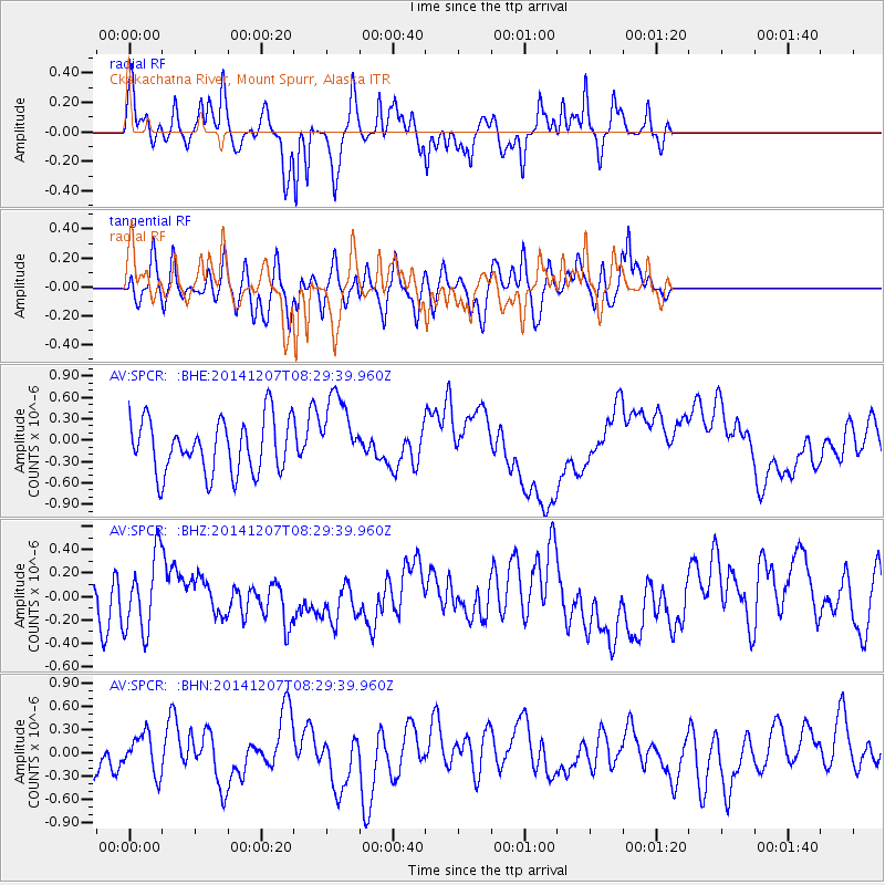
SPCR Ckakachatna River, Mount Spurr, Alaska - Earthquake Result Viewer
*The percent match for this event was below the threshold and hence no stack was calculated.
| Earthquake location: |
Solomon Islands |
| Earthquake latitude/longitude: |
-6.4/154.4 |
| Earthquake time(UTC): |
2014/12/07 (341) 08:18:07 GMT |
| Earthquake Depth: |
10 km |
| Earthquake Magnitude: |
5.2 MW, 5.2 mb |
| Earthquake Catalog/Contributor: |
ISC/ISC |
|
| Network: |
AV Alaska Volcano Observatory |
| Station: |
SPCR Ckakachatna River, Mount Spurr, Alaska |
| Lat/Lon: |
61.20 N/152.21 W |
| Elevation: |
984 m |
|
| Distance: |
79.0 deg |
| Az: |
23.33 deg |
| Baz: |
234.375 deg |
| Ray Param: |
$rayparam |
*The percent match for this event was below the threshold and hence was not used in the summary stack. |
|
| Radial Match: |
67.30073 % |
| Radial Bump: |
324 |
| Transverse Match: |
52.048912 % |
| Transverse Bump: |
400 |
| SOD ConfigId: |
3390531 |
| Insert Time: |
2019-04-15 10:02:38.558 +0000 |
| GWidth: |
2.5 |
| Max Bumps: |
400 |
| Tol: |
0.001 |
|
Signal To Noise
| Channel | StoN | STA | LTA |
| AV:SPCR: :BHZ:20141207T08:29:39.960Z | 1.3006469 | 3.1648577E-7 | 2.433295E-7 |
| AV:SPCR: :BHN:20141207T08:29:39.960Z | 0.8650381 | 2.5139047E-7 | 2.90612E-7 |
| AV:SPCR: :BHE:20141207T08:29:39.960Z | 1.4308689 | 5.3671357E-7 | 3.7509628E-7 |
| Arrivals |
| Ps | |
| PpPs | |
| PsPs/PpSs | |


