
Z50A Ashland, AL, USA - Earthquake Result Viewer
| ||||||||||||||||||
| ||||||||||||||||||
| ||||||||||||||||||
|
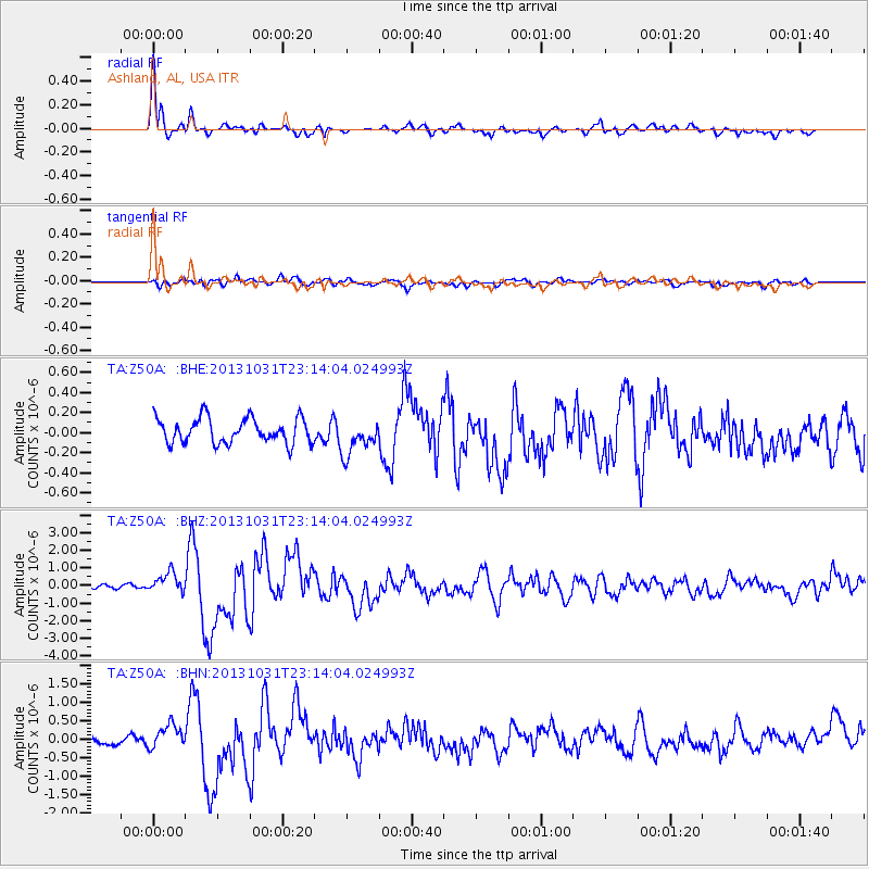
Signal To Noise
| Channel | StoN | STA | LTA |
| TA:Z50A: :BHZ:20131031T23:14:04.024993Z | 4.636137 | 5.7564273E-7 | 1.241643E-7 |
| TA:Z50A: :BHN:20131031T23:14:04.024993Z | 2.9829009 | 3.1936918E-7 | 1.0706664E-7 |
| TA:Z50A: :BHE:20131031T23:14:04.024993Z | 1.407275 | 1.753269E-7 | 1.245861E-7 |
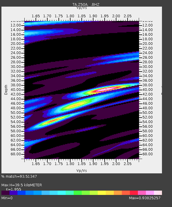
| Arrivals | |
| Ps | 5.9 SECOND |
| PpPs | 17 SECOND |
| PsPs/PpSs | 23 SECOND |

