You are here: Home > Network List > CI - Caltech Regional Seismic Network Stations List
> Station MPM Manuel Prospect Mine, California, USA > Earthquake Result Viewer
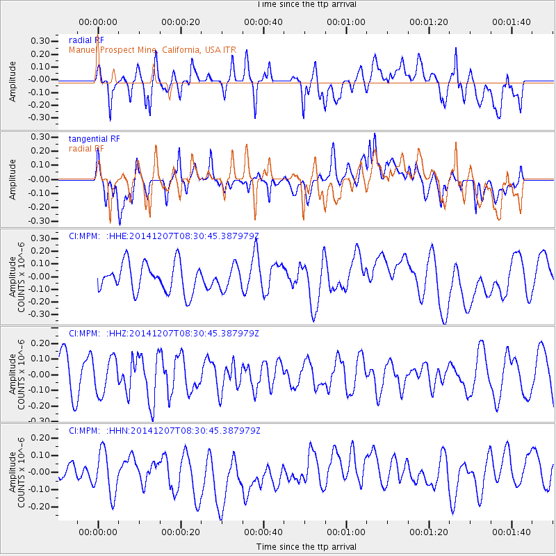
MPM Manuel Prospect Mine, California, USA - Earthquake Result Viewer
*The percent match for this event was below the threshold and hence no stack was calculated.
| Earthquake location: |
Solomon Islands |
| Earthquake latitude/longitude: |
-6.4/154.4 |
| Earthquake time(UTC): |
2014/12/07 (341) 08:18:07 GMT |
| Earthquake Depth: |
10 km |
| Earthquake Magnitude: |
5.2 MW, 5.2 mb |
| Earthquake Catalog/Contributor: |
ISC/ISC |
|
| Network: |
CI Caltech Regional Seismic Network |
| Station: |
MPM Manuel Prospect Mine, California, USA |
| Lat/Lon: |
36.06 N/117.49 W |
| Elevation: |
185 m |
|
| Distance: |
92.2 deg |
| Az: |
54.141 deg |
| Baz: |
263.769 deg |
| Ray Param: |
$rayparam |
*The percent match for this event was below the threshold and hence was not used in the summary stack. |
|
| Radial Match: |
48.258915 % |
| Radial Bump: |
400 |
| Transverse Match: |
44.39504 % |
| Transverse Bump: |
400 |
| SOD ConfigId: |
3390531 |
| Insert Time: |
2019-04-15 10:03:15.708 +0000 |
| GWidth: |
2.5 |
| Max Bumps: |
400 |
| Tol: |
0.001 |
|
Signal To Noise
| Channel | StoN | STA | LTA |
| CI:MPM: :HHZ:20141207T08:30:45.387979Z | 0.9380576 | 1.13125445E-7 | 1.2059542E-7 |
| CI:MPM: :HHN:20141207T08:30:45.387979Z | 1.5731932 | 1.4595888E-7 | 9.277874E-8 |
| CI:MPM: :HHE:20141207T08:30:45.387979Z | 0.8213303 | 9.3244154E-8 | 1.135282E-7 |
| Arrivals |
| Ps | |
| PpPs | |
| PsPs/PpSs | |


