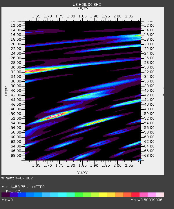
HDIL Hopedale, Illinois, USA - Earthquake Result Viewer
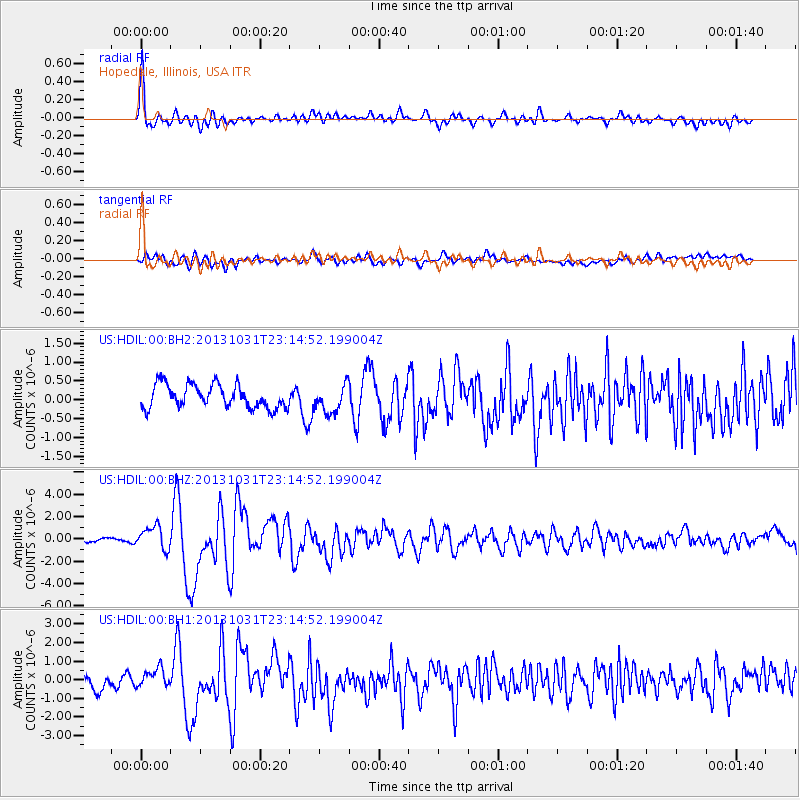
Earthquake location: Near Coast Of Central Chile
Earthquake latitude/longitude: -30.3/-71.5
Earthquake time(UTC): 2013/10/31 (304) 23:03:59 GMT
Earthquake Depth: 27 km
Earthquake Magnitude: 6.6 MWW, 6.4 MWB, 6.5 MWC, 6.6 MWW, 6.6 MI
Earthquake Catalog/Contributor: NEIC PDE/NEIC COMCAT
Network: US United States National Seismic Network
Station: HDIL Hopedale, Illinois, USA
Lat/Lon: 40.56 N/89.29 W
Elevation: 219 m
Distance: 72.4 deg
Az: 345.877 deg
Baz: 163.919 deg
Ray Param: 0.05365547
Estimated Moho Depth: 50.75 km
Estimated Crust Vp/Vs: 1.73
Assumed Crust Vp: 6.498 km/s
Estimated Crust Vs: 3.767 km/s
Estimated Crust Poisson's Ratio: 0.25
Radial Match: 87.882 %
Radial Bump: 400
Transverse Match: 65.11399 %
Transverse Bump: 400
SOD ConfigId: 626651
Insert Time: 2014-04-19 09:26:31.858 +0000
GWidth: 2.5
Max Bumps: 400
Tol: 0.001

Signal To Noise

ChannelStoNSTALTA
US:HDIL:00:BHZ:20131031T23:14:52.199004Z3.89334631.0263653E-62.6362036E-7
US:HDIL:00:BH1:20131031T23:14:52.199004Z1.41815824.791976E-73.3790135E-7
US:HDIL:00:BH2:20131031T23:14:52.199004Z1.19579463.703094E-73.0967644E-7
Arrivals
Ps5.9 SECOND
PpPs21 SECOND
PsPs/PpSs26 SECOND