You are here: Home > Network List > AZ - ANZA Regional Network Stations List
> Station LVA2 AZ.LVA2 > Earthquake Result Viewer
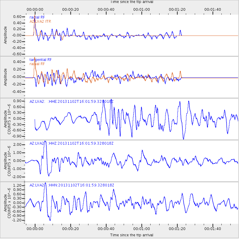
LVA2 AZ.LVA2 - Earthquake Result Viewer
*The percent match for this event was below the threshold and hence no stack was calculated.
| Earthquake location: |
Easter Island Region |
| Earthquake latitude/longitude: |
-23.6/-112.6 |
| Earthquake time(UTC): |
2013/11/02 (306) 15:52:46 GMT |
| Earthquake Depth: |
10 km |
| Earthquake Magnitude: |
6.0 MWW, 5.9 MWB, 6.0 MWW, 6.0 MWC, 6.1 MWC |
| Earthquake Catalog/Contributor: |
NEIC PDE/NEIC COMCAT |
|
| Network: |
AZ ANZA Regional Network |
| Station: |
LVA2 AZ.LVA2 |
| Lat/Lon: |
33.35 N/116.56 W |
| Elevation: |
1435 m |
|
| Distance: |
56.8 deg |
| Az: |
356.033 deg |
| Baz: |
175.652 deg |
| Ray Param: |
$rayparam |
*The percent match for this event was below the threshold and hence was not used in the summary stack. |
|
| Radial Match: |
77.26783 % |
| Radial Bump: |
400 |
| Transverse Match: |
50.68884 % |
| Transverse Bump: |
400 |
| SOD ConfigId: |
626651 |
| Insert Time: |
2014-04-19 09:37:37.355 +0000 |
| GWidth: |
2.5 |
| Max Bumps: |
400 |
| Tol: |
0.001 |
|
Signal To Noise
| Channel | StoN | STA | LTA |
| AZ:LVA2: :HHZ:20131102T16:01:59.328018Z | 6.9633665 | 5.657532E-7 | 8.124709E-8 |
| AZ:LVA2: :HHN:20131102T16:01:59.328018Z | 1.1864556 | 2.3626824E-7 | 1.9913787E-7 |
| AZ:LVA2: :HHE:20131102T16:01:59.328018Z | 1.108188 | 2.6054343E-7 | 2.351076E-7 |
| Arrivals |
| Ps | |
| PpPs | |
| PsPs/PpSs | |


