You are here: Home > Network List > CN - Canadian National Seismograph Network Stations List
> Station INK INUVIK, NT > Earthquake Result Viewer
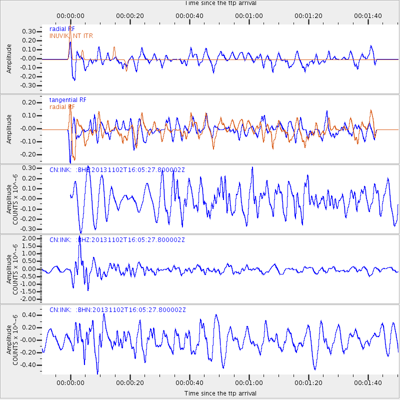
INK INUVIK, NT - Earthquake Result Viewer
*The percent match for this event was below the threshold and hence no stack was calculated.
| Earthquake location: |
Easter Island Region |
| Earthquake latitude/longitude: |
-23.6/-112.6 |
| Earthquake time(UTC): |
2013/11/02 (306) 15:52:46 GMT |
| Earthquake Depth: |
10 km |
| Earthquake Magnitude: |
6.0 MWW, 5.9 MWB, 6.0 MWW, 6.0 MWC, 6.1 MWC |
| Earthquake Catalog/Contributor: |
NEIC PDE/NEIC COMCAT |
|
| Network: |
CN Canadian National Seismograph Network |
| Station: |
INK INUVIK, NT |
| Lat/Lon: |
68.31 N/133.53 W |
| Elevation: |
44 m |
|
| Distance: |
93.0 deg |
| Az: |
352.358 deg |
| Baz: |
160.85 deg |
| Ray Param: |
$rayparam |
*The percent match for this event was below the threshold and hence was not used in the summary stack. |
|
| Radial Match: |
71.82377 % |
| Radial Bump: |
400 |
| Transverse Match: |
61.636364 % |
| Transverse Bump: |
400 |
| SOD ConfigId: |
626651 |
| Insert Time: |
2014-04-19 09:41:00.441 +0000 |
| GWidth: |
2.5 |
| Max Bumps: |
400 |
| Tol: |
0.001 |
|
Signal To Noise
| Channel | StoN | STA | LTA |
| CN:INK: :BHZ:20131102T16:05:27.800002Z | 5.5288057 | 8.297904E-7 | 1.5008493E-7 |
| CN:INK: :BHN:20131102T16:05:27.800002Z | 1.4182163 | 1.62187E-7 | 1.1435985E-7 |
| CN:INK: :BHE:20131102T16:05:27.800002Z | 1.2217301 | 1.7504809E-7 | 1.4327884E-7 |
| Arrivals |
| Ps | |
| PpPs | |
| PsPs/PpSs | |


