You are here: Home > Network List > HV - Hawaiian Volcano Observatory Network Stations List
> Station MLOD Mauna Loa, Hawaii Digital > Earthquake Result Viewer
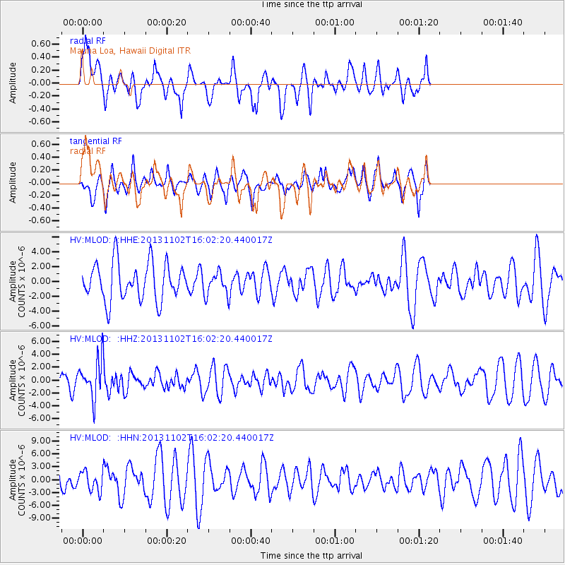
MLOD Mauna Loa, Hawaii Digital - Earthquake Result Viewer
*The percent match for this event was below the threshold and hence no stack was calculated.
| Earthquake location: |
Easter Island Region |
| Earthquake latitude/longitude: |
-23.6/-112.6 |
| Earthquake time(UTC): |
2013/11/02 (306) 15:52:46 GMT |
| Earthquake Depth: |
10 km |
| Earthquake Magnitude: |
6.0 MWW, 5.9 MWB, 6.0 MWW, 6.0 MWC, 6.1 MWC |
| Earthquake Catalog/Contributor: |
NEIC PDE/NEIC COMCAT |
|
| Network: |
HV Hawaiian Volcano Observatory Network |
| Station: |
MLOD Mauna Loa, Hawaii Digital |
| Lat/Lon: |
19.49 N/155.39 W |
| Elevation: |
2044 m |
|
| Distance: |
59.8 deg |
| Az: |
312.156 deg |
| Baz: |
133.891 deg |
| Ray Param: |
$rayparam |
*The percent match for this event was below the threshold and hence was not used in the summary stack. |
|
| Radial Match: |
58.239662 % |
| Radial Bump: |
400 |
| Transverse Match: |
70.78363 % |
| Transverse Bump: |
361 |
| SOD ConfigId: |
626651 |
| Insert Time: |
2014-04-19 09:43:33.745 +0000 |
| GWidth: |
2.5 |
| Max Bumps: |
400 |
| Tol: |
0.001 |
|
Signal To Noise
| Channel | StoN | STA | LTA |
| HV:MLOD: :HHZ:20131102T16:02:20.440017Z | 3.3559303 | 3.02488E-6 | 9.0135364E-7 |
| HV:MLOD: :HHN:20131102T16:02:20.440017Z | 0.82081497 | 2.2993138E-6 | 2.801257E-6 |
| HV:MLOD: :HHE:20131102T16:02:20.440017Z | 0.62798876 | 1.5854868E-6 | 2.5247057E-6 |
| Arrivals |
| Ps | |
| PpPs | |
| PsPs/PpSs | |


