You are here: Home > Network List > IW - Intermountain West Stations List
> Station PLID Pearl Lake, Idaho, USA > Earthquake Result Viewer
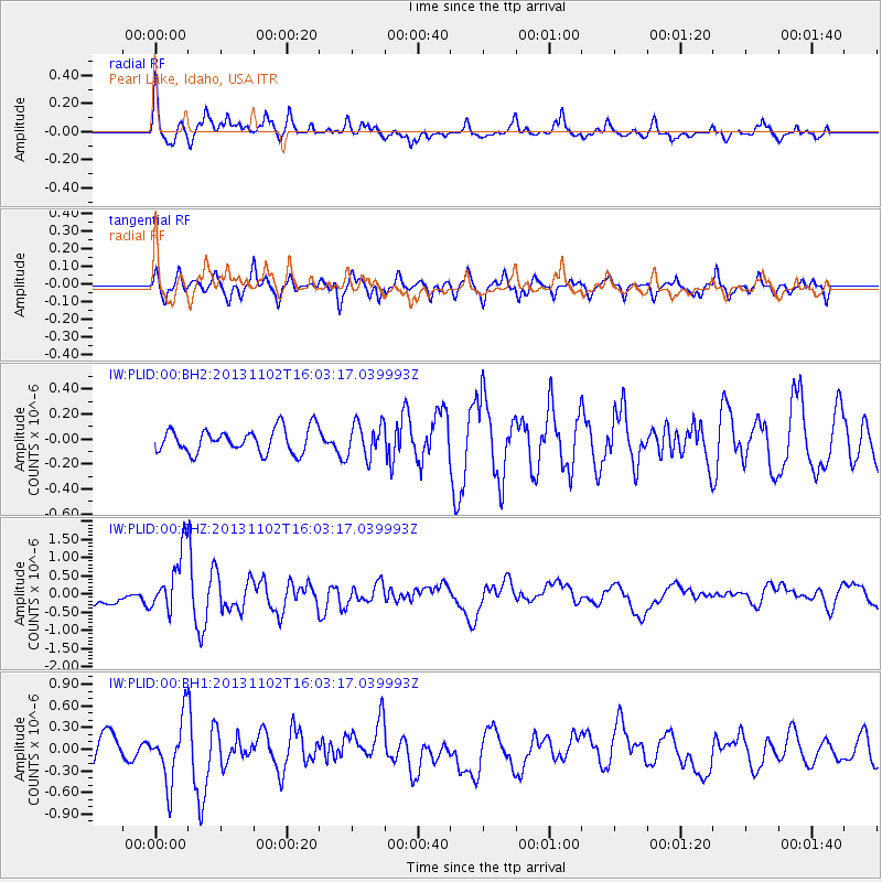
PLID Pearl Lake, Idaho, USA - Earthquake Result Viewer
*The percent match for this event was below the threshold and hence no stack was calculated.
| Earthquake location: |
Easter Island Region |
| Earthquake latitude/longitude: |
-23.6/-112.6 |
| Earthquake time(UTC): |
2013/11/02 (306) 15:52:46 GMT |
| Earthquake Depth: |
10 km |
| Earthquake Magnitude: |
6.0 MWW, 5.9 MWB, 6.0 MWW, 6.0 MWC, 6.1 MWC |
| Earthquake Catalog/Contributor: |
NEIC PDE/NEIC COMCAT |
|
| Network: |
IW Intermountain West |
| Station: |
PLID Pearl Lake, Idaho, USA |
| Lat/Lon: |
45.09 N/116.00 W |
| Elevation: |
2164 m |
|
| Distance: |
68.5 deg |
| Az: |
357.408 deg |
| Baz: |
176.643 deg |
| Ray Param: |
$rayparam |
*The percent match for this event was below the threshold and hence was not used in the summary stack. |
|
| Radial Match: |
68.05228 % |
| Radial Bump: |
375 |
| Transverse Match: |
77.98771 % |
| Transverse Bump: |
400 |
| SOD ConfigId: |
626651 |
| Insert Time: |
2014-04-19 09:45:59.385 +0000 |
| GWidth: |
2.5 |
| Max Bumps: |
400 |
| Tol: |
0.001 |
|
Signal To Noise
| Channel | StoN | STA | LTA |
| IW:PLID:00:BHZ:20131102T16:03:17.039993Z | 4.358391 | 8.6020015E-7 | 1.9736648E-7 |
| IW:PLID:00:BH1:20131102T16:03:17.039993Z | 2.5764942 | 4.368713E-7 | 1.6956037E-7 |
| IW:PLID:00:BH2:20131102T16:03:17.039993Z | 1.424744 | 1.3600233E-7 | 9.5457374E-8 |
| Arrivals |
| Ps | |
| PpPs | |
| PsPs/PpSs | |


