You are here: Home > Network List > TA - USArray Transportable Network (new EarthScope stations) Stations List
> Station D48A Paudash Township, ON, CAN > Earthquake Result Viewer
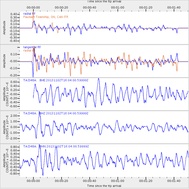
D48A Paudash Township, ON, CAN - Earthquake Result Viewer
*The percent match for this event was below the threshold and hence no stack was calculated.
| Earthquake location: |
Easter Island Region |
| Earthquake latitude/longitude: |
-23.6/-112.6 |
| Earthquake time(UTC): |
2013/11/02 (306) 15:52:46 GMT |
| Earthquake Depth: |
10 km |
| Earthquake Magnitude: |
6.0 MWW, 5.9 MWB, 6.0 MWW, 6.0 MWC, 6.1 MWC |
| Earthquake Catalog/Contributor: |
NEIC PDE/NEIC COMCAT |
|
| Network: |
TA USArray Transportable Network (new EarthScope stations) |
| Station: |
D48A Paudash Township, ON, CAN |
| Lat/Lon: |
47.17 N/81.81 W |
| Elevation: |
434 m |
|
| Distance: |
75.8 deg |
| Az: |
21.117 deg |
| Baz: |
208.968 deg |
| Ray Param: |
$rayparam |
*The percent match for this event was below the threshold and hence was not used in the summary stack. |
|
| Radial Match: |
67.67291 % |
| Radial Bump: |
392 |
| Transverse Match: |
65.07011 % |
| Transverse Bump: |
400 |
| SOD ConfigId: |
626651 |
| Insert Time: |
2014-04-19 09:55:51.788 +0000 |
| GWidth: |
2.5 |
| Max Bumps: |
400 |
| Tol: |
0.001 |
|
Signal To Noise
| Channel | StoN | STA | LTA |
| TA:D48A: :BHZ:20131102T16:04:00.59999Z | 4.187091 | 1.2492266E-6 | 2.983519E-7 |
| TA:D48A: :BHN:20131102T16:04:00.59999Z | 1.7167861 | 4.5030455E-7 | 2.622951E-7 |
| TA:D48A: :BHE:20131102T16:04:00.59999Z | 0.8946812 | 2.2258202E-7 | 2.487836E-7 |
| Arrivals |
| Ps | |
| PpPs | |
| PsPs/PpSs | |


