You are here: Home > Network List > TA - USArray Transportable Network (new EarthScope stations) Stations List
> Station K55A Perry, NY, USA > Earthquake Result Viewer
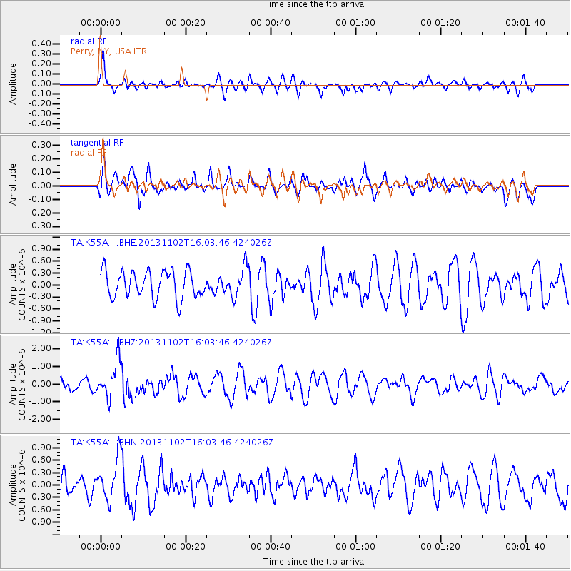
K55A Perry, NY, USA - Earthquake Result Viewer
*The percent match for this event was below the threshold and hence no stack was calculated.
| Earthquake location: |
Easter Island Region |
| Earthquake latitude/longitude: |
-23.6/-112.6 |
| Earthquake time(UTC): |
2013/11/02 (306) 15:52:46 GMT |
| Earthquake Depth: |
10 km |
| Earthquake Magnitude: |
6.0 MWW, 5.9 MWB, 6.0 MWW, 6.0 MWC, 6.1 MWC |
| Earthquake Catalog/Contributor: |
NEIC PDE/NEIC COMCAT |
|
| Network: |
TA USArray Transportable Network (new EarthScope stations) |
| Station: |
K55A Perry, NY, USA |
| Lat/Lon: |
42.73 N/78.07 W |
| Elevation: |
482 m |
|
| Distance: |
73.3 deg |
| Az: |
25.849 deg |
| Baz: |
212.865 deg |
| Ray Param: |
$rayparam |
*The percent match for this event was below the threshold and hence was not used in the summary stack. |
|
| Radial Match: |
54.78474 % |
| Radial Bump: |
400 |
| Transverse Match: |
50.752747 % |
| Transverse Bump: |
400 |
| SOD ConfigId: |
626651 |
| Insert Time: |
2014-04-19 10:01:29.393 +0000 |
| GWidth: |
2.5 |
| Max Bumps: |
400 |
| Tol: |
0.001 |
|
Signal To Noise
| Channel | StoN | STA | LTA |
| TA:K55A: :BHZ:20131102T16:03:46.424026Z | 3.4441912 | 1.075468E-6 | 3.122556E-7 |
| TA:K55A: :BHN:20131102T16:03:46.424026Z | 1.8352497 | 5.209054E-7 | 2.8383354E-7 |
| TA:K55A: :BHE:20131102T16:03:46.424026Z | 1.0903101 | 3.683319E-7 | 3.3782308E-7 |
| Arrivals |
| Ps | |
| PpPs | |
| PsPs/PpSs | |


