You are here: Home > Network List > II - Global Seismograph Network (GSN - IRIS/IDA) Stations List
> Station TAU Hobart, Tasmania, Australia > Earthquake Result Viewer
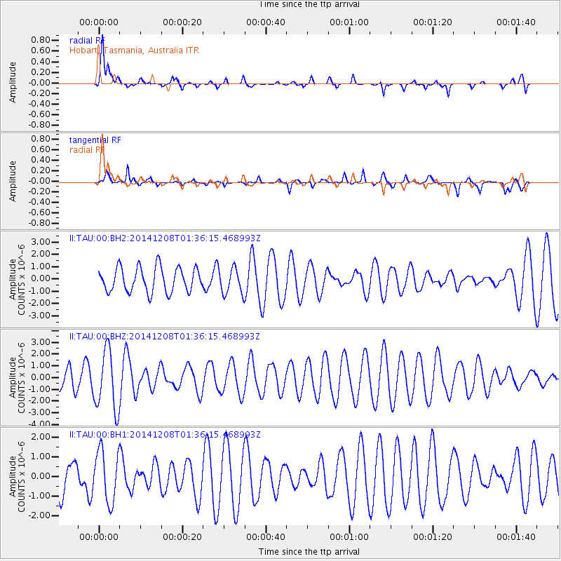
TAU Hobart, Tasmania, Australia - Earthquake Result Viewer
*The percent match for this event was below the threshold and hence no stack was calculated.
| Earthquake location: |
Northern Molucca Sea |
| Earthquake latitude/longitude: |
1.7/126.9 |
| Earthquake time(UTC): |
2014/12/08 (342) 01:28:18 GMT |
| Earthquake Depth: |
118 km |
| Earthquake Magnitude: |
4.9 MW, 5.2 mb |
| Earthquake Catalog/Contributor: |
ISC/ISC |
|
| Network: |
II Global Seismograph Network (GSN - IRIS/IDA) |
| Station: |
TAU Hobart, Tasmania, Australia |
| Lat/Lon: |
42.91 S/147.32 E |
| Elevation: |
132 m |
|
| Distance: |
48.1 deg |
| Az: |
159.88 deg |
| Baz: |
332.096 deg |
| Ray Param: |
$rayparam |
*The percent match for this event was below the threshold and hence was not used in the summary stack. |
|
| Radial Match: |
70.19556 % |
| Radial Bump: |
333 |
| Transverse Match: |
67.2467 % |
| Transverse Bump: |
302 |
| SOD ConfigId: |
3390531 |
| Insert Time: |
2019-04-15 10:30:19.622 +0000 |
| GWidth: |
2.5 |
| Max Bumps: |
400 |
| Tol: |
0.001 |
|
Signal To Noise
| Channel | StoN | STA | LTA |
| II:TAU:00:BHZ:20141208T01:36:15.468993Z | 1.7682273 | 2.5980476E-6 | 1.4692951E-6 |
| II:TAU:00:BH1:20141208T01:36:15.468993Z | 1.3917149 | 1.3390353E-6 | 9.621476E-7 |
| II:TAU:00:BH2:20141208T01:36:15.468993Z | 1.0574018 | 1.049557E-6 | 9.92581E-7 |
| Arrivals |
| Ps | |
| PpPs | |
| PsPs/PpSs | |


