You are here: Home > Network List > TA - USArray Transportable Network (new EarthScope stations) Stations List
> Station W39A Magazine, AR, USA > Earthquake Result Viewer
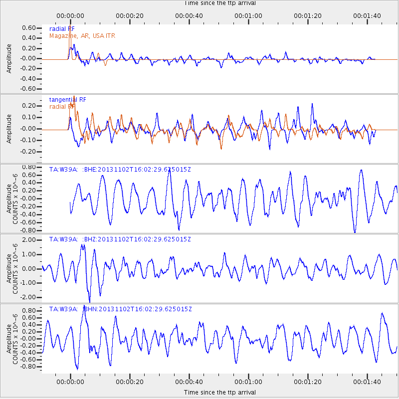
W39A Magazine, AR, USA - Earthquake Result Viewer
*The percent match for this event was below the threshold and hence no stack was calculated.
| Earthquake location: |
Easter Island Region |
| Earthquake latitude/longitude: |
-23.6/-112.6 |
| Earthquake time(UTC): |
2013/11/02 (306) 15:52:46 GMT |
| Earthquake Depth: |
10 km |
| Earthquake Magnitude: |
6.0 MWW, 5.9 MWB, 6.0 MWW, 6.0 MWC, 6.1 MWC |
| Earthquake Catalog/Contributor: |
NEIC PDE/NEIC COMCAT |
|
| Network: |
TA USArray Transportable Network (new EarthScope stations) |
| Station: |
W39A Magazine, AR, USA |
| Lat/Lon: |
35.20 N/93.78 W |
| Elevation: |
162 m |
|
| Distance: |
61.2 deg |
| Az: |
17.545 deg |
| Baz: |
199.729 deg |
| Ray Param: |
$rayparam |
*The percent match for this event was below the threshold and hence was not used in the summary stack. |
|
| Radial Match: |
66.13885 % |
| Radial Bump: |
378 |
| Transverse Match: |
62.434303 % |
| Transverse Bump: |
400 |
| SOD ConfigId: |
626651 |
| Insert Time: |
2014-04-19 10:09:59.744 +0000 |
| GWidth: |
2.5 |
| Max Bumps: |
400 |
| Tol: |
0.001 |
|
Signal To Noise
| Channel | StoN | STA | LTA |
| TA:W39A: :BHZ:20131102T16:02:29.625015Z | 2.7739346 | 9.035884E-7 | 3.257425E-7 |
| TA:W39A: :BHN:20131102T16:02:29.625015Z | 1.6524594 | 5.3878216E-7 | 3.2604868E-7 |
| TA:W39A: :BHE:20131102T16:02:29.625015Z | 1.2948227 | 3.9757626E-7 | 3.0705073E-7 |
| Arrivals |
| Ps | |
| PpPs | |
| PsPs/PpSs | |


