HOWD HOWD - Earthquake Result Viewer
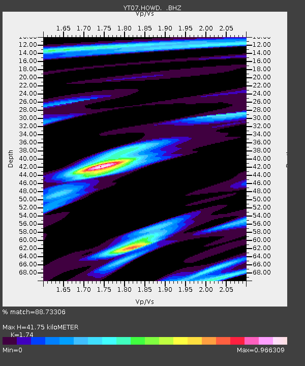
Earthquake location: Easter Island Region
Earthquake latitude/longitude: -23.6/-112.6
Earthquake time(UTC): 2013/11/02 (306) 15:52:46 GMT
Earthquake Depth: 10 km
Earthquake Magnitude: 6.0 MWW, 5.9 MWB, 6.0 MWW, 6.0 MWC, 6.1 MWC
Earthquake Catalog/Contributor: NEIC PDE/NEIC COMCAT
Network: YT POLENET
Station: HOWD HOWD
Lat/Lon: 77.53 S/86.77 W
Elevation: 1495 m
Distance: 55.4 deg
Az: 173.391 deg
Baz: 330.944 deg
Ray Param: 0.06484984
Estimated Moho Depth: 41.75 km
Estimated Crust Vp/Vs: 1.74
Assumed Crust Vp: 6.047 km/s
Estimated Crust Vs: 3.475 km/s
Estimated Crust Poisson's Ratio: 0.25
Radial Match: 88.73306 %
Radial Bump: 322
Transverse Match: 69.01479 %
Transverse Bump: 400
SOD ConfigId: 626651
Insert Time: 2014-04-19 10:19:16.667 +0000
GWidth: 2.5
Max Bumps: 400
Tol: 0.001

Signal To Noise

ChannelStoNSTALTA
YT:HOWD: :BHZ:20131102T16:01:48.998977Z2.37911224.1070092E-71.726278E-7
YT:HOWD: :BHN:20131102T16:01:48.998977Z1.51053022.5042362E-71.6578525E-7
YT:HOWD: :BHE:20131102T16:01:48.998977Z1.3956561.723975E-71.2352436E-7
Arrivals
Ps5.4 SECOND
PpPs18 SECOND
PsPs/PpSs23 SECOND