You are here: Home > Network List > AV - Alaska Volcano Observatory Stations List
> Station AUJA Augustine Cone H, Augustine Volcano, Alaska > Earthquake Result Viewer
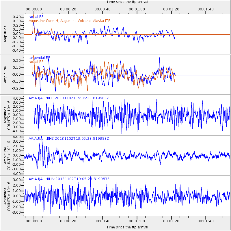
AUJA Augustine Cone H, Augustine Volcano, Alaska - Earthquake Result Viewer
*The percent match for this event was below the threshold and hence no stack was calculated.
| Earthquake location: |
Tonga Islands Region |
| Earthquake latitude/longitude: |
-19.2/-172.6 |
| Earthquake time(UTC): |
2013/11/02 (306) 18:53:46 GMT |
| Earthquake Depth: |
10 km |
| Earthquake Magnitude: |
6.2 MWW, 6.2 MWB, 6.2 MWW, 6.3 MWC, 6.5 MI |
| Earthquake Catalog/Contributor: |
NEIC PDE/NEIC COMCAT |
|
| Network: |
AV Alaska Volcano Observatory |
| Station: |
AUJA Augustine Cone H, Augustine Volcano, Alaska |
| Lat/Lon: |
59.34 N/153.42 W |
| Elevation: |
376 m |
|
| Distance: |
79.8 deg |
| Az: |
9.87 deg |
| Baz: |
198.429 deg |
| Ray Param: |
$rayparam |
*The percent match for this event was below the threshold and hence was not used in the summary stack. |
|
| Radial Match: |
53.227364 % |
| Radial Bump: |
400 |
| Transverse Match: |
41.6173 % |
| Transverse Bump: |
400 |
| SOD ConfigId: |
626651 |
| Insert Time: |
2014-04-19 10:25:26.657 +0000 |
| GWidth: |
2.5 |
| Max Bumps: |
400 |
| Tol: |
0.001 |
|
Signal To Noise
| Channel | StoN | STA | LTA |
| AV:AUJA: :BHZ:20131102T19:05:23.819983Z | 5.5756803 | 1.7810596E-6 | 3.1943358E-7 |
| AV:AUJA: :BHN:20131102T19:05:23.819983Z | 1.4250672 | 9.2858346E-7 | 6.516068E-7 |
| AV:AUJA: :BHE:20131102T19:05:23.819983Z | 0.98389906 | 1.3170987E-6 | 1.3386523E-6 |
| Arrivals |
| Ps | |
| PpPs | |
| PsPs/PpSs | |


