You are here: Home > Network List > AZ - ANZA Regional Network Stations List
> Station SMER AZ.SMER > Earthquake Result Viewer
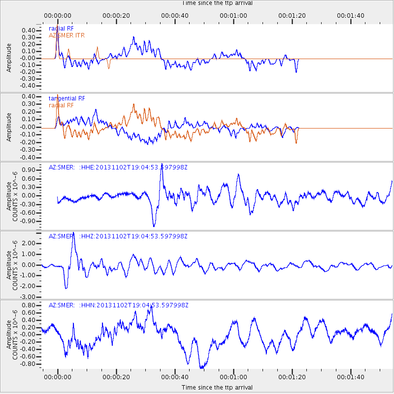
SMER AZ.SMER - Earthquake Result Viewer
*The percent match for this event was below the threshold and hence no stack was calculated.
| Earthquake location: |
Tonga Islands Region |
| Earthquake latitude/longitude: |
-19.2/-172.6 |
| Earthquake time(UTC): |
2013/11/02 (306) 18:53:46 GMT |
| Earthquake Depth: |
10 km |
| Earthquake Magnitude: |
6.2 MWW, 6.2 MWB, 6.2 MWW, 6.3 MWC, 6.5 MI |
| Earthquake Catalog/Contributor: |
NEIC PDE/NEIC COMCAT |
|
| Network: |
AZ ANZA Regional Network |
| Station: |
SMER AZ.SMER |
| Lat/Lon: |
33.46 N/117.17 W |
| Elevation: |
355 m |
|
| Distance: |
74.4 deg |
| Az: |
45.646 deg |
| Baz: |
233.945 deg |
| Ray Param: |
$rayparam |
*The percent match for this event was below the threshold and hence was not used in the summary stack. |
|
| Radial Match: |
59.753628 % |
| Radial Bump: |
400 |
| Transverse Match: |
41.07314 % |
| Transverse Bump: |
400 |
| SOD ConfigId: |
626651 |
| Insert Time: |
2014-04-19 10:26:26.982 +0000 |
| GWidth: |
2.5 |
| Max Bumps: |
400 |
| Tol: |
0.001 |
|
Signal To Noise
| Channel | StoN | STA | LTA |
| AZ:SMER: :HHZ:20131102T19:04:53.597998Z | 6.1107173 | 9.508018E-7 | 1.5559577E-7 |
| AZ:SMER: :HHN:20131102T19:04:53.597998Z | 0.9512661 | 2.8254584E-7 | 2.9702082E-7 |
| AZ:SMER: :HHE:20131102T19:04:53.597998Z | 4.993187 | 4.701721E-7 | 9.416273E-8 |
| Arrivals |
| Ps | |
| PpPs | |
| PsPs/PpSs | |


