You are here: Home > Network List > BK - Berkeley Digital Seismograph Network Stations List
> Station MCCM Marconi Conference Center, Marshall, CA, USA > Earthquake Result Viewer
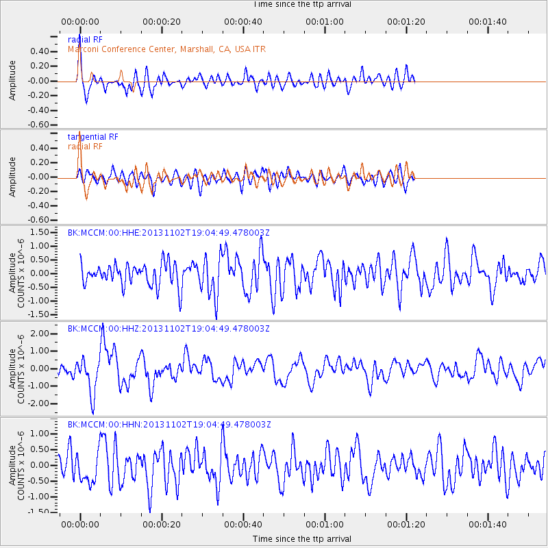
MCCM Marconi Conference Center, Marshall, CA, USA - Earthquake Result Viewer
*The percent match for this event was below the threshold and hence no stack was calculated.
| Earthquake location: |
Tonga Islands Region |
| Earthquake latitude/longitude: |
-19.2/-172.6 |
| Earthquake time(UTC): |
2013/11/02 (306) 18:53:46 GMT |
| Earthquake Depth: |
10 km |
| Earthquake Magnitude: |
6.2 MWW, 6.2 MWB, 6.2 MWW, 6.3 MWC, 6.5 MI |
| Earthquake Catalog/Contributor: |
NEIC PDE/NEIC COMCAT |
|
| Network: |
BK Berkeley Digital Seismograph Network |
| Station: |
MCCM Marconi Conference Center, Marshall, CA, USA |
| Lat/Lon: |
38.14 N/122.88 W |
| Elevation: |
-7.7 m |
|
| Distance: |
73.7 deg |
| Az: |
38.835 deg |
| Baz: |
228.743 deg |
| Ray Param: |
$rayparam |
*The percent match for this event was below the threshold and hence was not used in the summary stack. |
|
| Radial Match: |
64.5935 % |
| Radial Bump: |
400 |
| Transverse Match: |
63.37374 % |
| Transverse Bump: |
400 |
| SOD ConfigId: |
626651 |
| Insert Time: |
2014-04-19 10:26:51.408 +0000 |
| GWidth: |
2.5 |
| Max Bumps: |
400 |
| Tol: |
0.001 |
|
Signal To Noise
| Channel | StoN | STA | LTA |
| BK:MCCM:00:HHZ:20131102T19:04:49.478003Z | 3.5596313 | 1.0228487E-6 | 2.8734678E-7 |
| BK:MCCM:00:HHN:20131102T19:04:49.478003Z | 1.4342664 | 4.6960506E-7 | 3.274183E-7 |
| BK:MCCM:00:HHE:20131102T19:04:49.478003Z | 1.8414137 | 7.302677E-7 | 3.965799E-7 |
| Arrivals |
| Ps | |
| PpPs | |
| PsPs/PpSs | |


