QSPA South Pole Remote Earth Science Observatory (Quiet Zone) - Earthquake Result Viewer
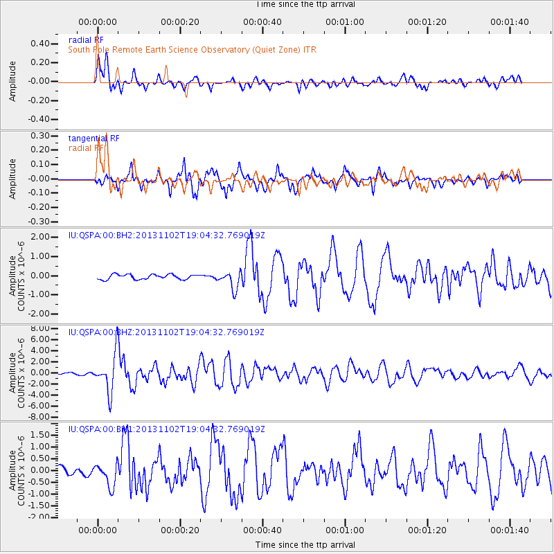
Earthquake location: Tonga Islands Region
Earthquake latitude/longitude: -19.2/-172.6
Earthquake time(UTC): 2013/11/02 (306) 18:53:46 GMT
Earthquake Depth: 10 km
Earthquake Magnitude: 6.2 MWW, 6.2 MWB, 6.2 MWW, 6.3 MWC, 6.5 MI
Earthquake Catalog/Contributor: NEIC PDE/NEIC COMCAT
Network: IU Global Seismograph Network (GSN - IRIS/USGS)
Station: QSPA South Pole Remote Earth Science Observatory (Quiet Zone)
Lat/Lon: 89.93 S/144.44 E
Elevation: 2850 m
Distance: 70.9 deg
Az: 180.052 deg
Baz: 42.938 deg
Ray Param: 0.054679397
Estimated Moho Depth: 21.0 km
Estimated Crust Vp/Vs: 1.60
Assumed Crust Vp: 6.193 km/s
Estimated Crust Vs: 3.871 km/s
Estimated Crust Poisson's Ratio: 0.18
Radial Match: 91.11703 %
Radial Bump: 400
Transverse Match: 89.69948 %
Transverse Bump: 400
SOD ConfigId: 626651
Insert Time: 2014-04-19 10:32:34.197 +0000
GWidth: 2.5
Max Bumps: 400
Tol: 0.001

Signal To Noise

ChannelStoNSTALTA
IU:QSPA:00:BHZ:20131102T19:04:32.769019Z21.1289883.5884025E-61.6983314E-7
IU:QSPA:00:BH1:20131102T19:04:32.769019Z3.17187624.966394E-71.5657591E-7
IU:QSPA:00:BH2:20131102T19:04:32.769019Z3.78066544.858225E-71.2850187E-7
Arrivals
Ps2.1 SECOND
PpPs8.5 SECOND
PsPs/PpSs11 SECOND