You are here: Home > Network List > TA - USArray Transportable Network (new EarthScope stations) Stations List
> Station MDND Maddock, ND, USA > Earthquake Result Viewer
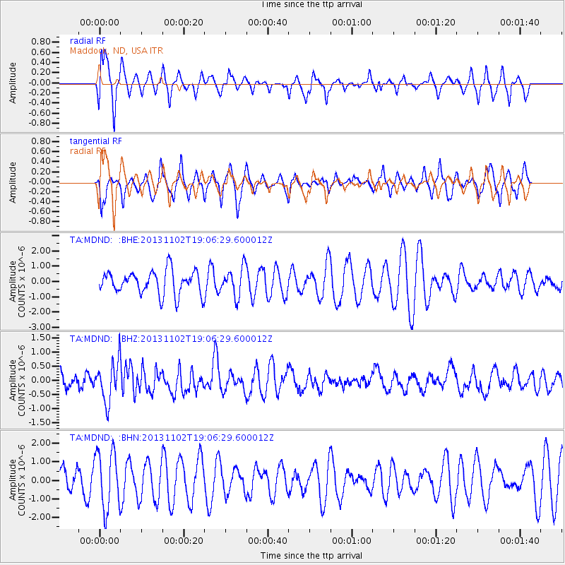
MDND Maddock, ND, USA - Earthquake Result Viewer
*The percent match for this event was below the threshold and hence no stack was calculated.
| Earthquake location: |
Tonga Islands Region |
| Earthquake latitude/longitude: |
-19.2/-172.6 |
| Earthquake time(UTC): |
2013/11/02 (306) 18:53:46 GMT |
| Earthquake Depth: |
10 km |
| Earthquake Magnitude: |
6.2 MWW, 6.2 MWB, 6.2 MWW, 6.3 MWC, 6.5 MI |
| Earthquake Catalog/Contributor: |
NEIC PDE/NEIC COMCAT |
|
| Network: |
TA USArray Transportable Network (new EarthScope stations) |
| Station: |
MDND Maddock, ND, USA |
| Lat/Lon: |
47.85 N/99.60 W |
| Elevation: |
479 m |
|
| Distance: |
93.2 deg |
| Az: |
40.186 deg |
| Baz: |
244.891 deg |
| Ray Param: |
$rayparam |
*The percent match for this event was below the threshold and hence was not used in the summary stack. |
|
| Radial Match: |
70.18833 % |
| Radial Bump: |
307 |
| Transverse Match: |
41.790768 % |
| Transverse Bump: |
292 |
| SOD ConfigId: |
626651 |
| Insert Time: |
2014-04-19 10:39:24.455 +0000 |
| GWidth: |
2.5 |
| Max Bumps: |
400 |
| Tol: |
0.001 |
|
Signal To Noise
| Channel | StoN | STA | LTA |
| TA:MDND: :BHZ:20131102T19:06:29.600012Z | 2.363148 | 7.328413E-7 | 3.101123E-7 |
| TA:MDND: :BHN:20131102T19:06:29.600012Z | 1.3089396 | 1.5759689E-6 | 1.2040043E-6 |
| TA:MDND: :BHE:20131102T19:06:29.600012Z | 1.2590976 | 9.603916E-7 | 7.627619E-7 |
| Arrivals |
| Ps | |
| PpPs | |
| PsPs/PpSs | |


