You are here: Home > Network List > US - United States National Seismic Network Stations List
> Station BOZ Bozeman, Montana, USA > Earthquake Result Viewer
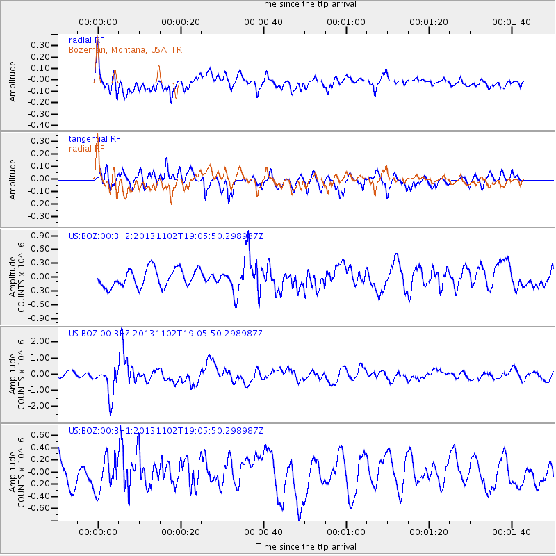
BOZ Bozeman, Montana, USA - Earthquake Result Viewer
*The percent match for this event was below the threshold and hence no stack was calculated.
| Earthquake location: |
Tonga Islands Region |
| Earthquake latitude/longitude: |
-19.2/-172.6 |
| Earthquake time(UTC): |
2013/11/02 (306) 18:53:46 GMT |
| Earthquake Depth: |
10 km |
| Earthquake Magnitude: |
6.2 MWW, 6.2 MWB, 6.2 MWW, 6.3 MWC, 6.5 MI |
| Earthquake Catalog/Contributor: |
NEIC PDE/NEIC COMCAT |
|
| Network: |
US United States National Seismic Network |
| Station: |
BOZ Bozeman, Montana, USA |
| Lat/Lon: |
45.65 N/111.63 W |
| Elevation: |
1589 m |
|
| Distance: |
84.9 deg |
| Az: |
38.026 deg |
| Baz: |
236.106 deg |
| Ray Param: |
$rayparam |
*The percent match for this event was below the threshold and hence was not used in the summary stack. |
|
| Radial Match: |
66.913635 % |
| Radial Bump: |
400 |
| Transverse Match: |
60.07922 % |
| Transverse Bump: |
400 |
| SOD ConfigId: |
626651 |
| Insert Time: |
2014-04-19 10:40:57.391 +0000 |
| GWidth: |
2.5 |
| Max Bumps: |
400 |
| Tol: |
0.001 |
|
Signal To Noise
| Channel | StoN | STA | LTA |
| US:BOZ:00:BHZ:20131102T19:05:50.298987Z | 4.6028767 | 9.456137E-7 | 2.0543972E-7 |
| US:BOZ:00:BH1:20131102T19:05:50.298987Z | 0.9228553 | 2.751178E-7 | 2.9811588E-7 |
| US:BOZ:00:BH2:20131102T19:05:50.298987Z | 1.3026437 | 2.5467753E-7 | 1.9550822E-7 |
| Arrivals |
| Ps | |
| PpPs | |
| PsPs/PpSs | |


