You are here: Home > Network List > US - United States National Seismic Network Stations List
> Station LAO LASA Array, Montana, USA > Earthquake Result Viewer
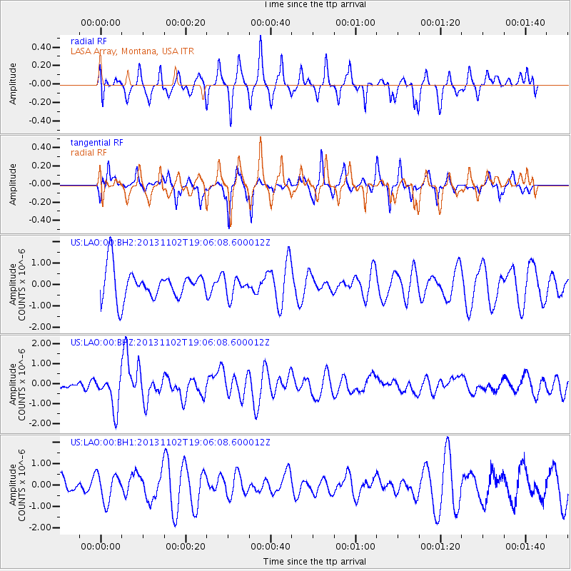
LAO LASA Array, Montana, USA - Earthquake Result Viewer
*The percent match for this event was below the threshold and hence no stack was calculated.
| Earthquake location: |
Tonga Islands Region |
| Earthquake latitude/longitude: |
-19.2/-172.6 |
| Earthquake time(UTC): |
2013/11/02 (306) 18:53:46 GMT |
| Earthquake Depth: |
10 km |
| Earthquake Magnitude: |
6.2 MWW, 6.2 MWB, 6.2 MWW, 6.3 MWC, 6.5 MI |
| Earthquake Catalog/Contributor: |
NEIC PDE/NEIC COMCAT |
|
| Network: |
US United States National Seismic Network |
| Station: |
LAO LASA Array, Montana, USA |
| Lat/Lon: |
46.69 N/106.22 W |
| Elevation: |
902 m |
|
| Distance: |
88.7 deg |
| Az: |
39.13 deg |
| Baz: |
240.057 deg |
| Ray Param: |
$rayparam |
*The percent match for this event was below the threshold and hence was not used in the summary stack. |
|
| Radial Match: |
52.034218 % |
| Radial Bump: |
364 |
| Transverse Match: |
53.846237 % |
| Transverse Bump: |
245 |
| SOD ConfigId: |
626651 |
| Insert Time: |
2014-04-19 10:41:35.578 +0000 |
| GWidth: |
2.5 |
| Max Bumps: |
400 |
| Tol: |
0.001 |
|
Signal To Noise
| Channel | StoN | STA | LTA |
| US:LAO:00:BHZ:20131102T19:06:08.600012Z | 3.1431205 | 8.893881E-7 | 2.829634E-7 |
| US:LAO:00:BH1:20131102T19:06:08.600012Z | 1.1176466 | 6.445051E-7 | 5.766627E-7 |
| US:LAO:00:BH2:20131102T19:06:08.600012Z | 0.6487622 | 4.532553E-7 | 6.9864626E-7 |
| Arrivals |
| Ps | |
| PpPs | |
| PsPs/PpSs | |


