You are here: Home > Network List > IU - Global Seismograph Network (GSN - IRIS/USGS) Stations List
> Station CTAO Charters Towers, Australia > Earthquake Result Viewer
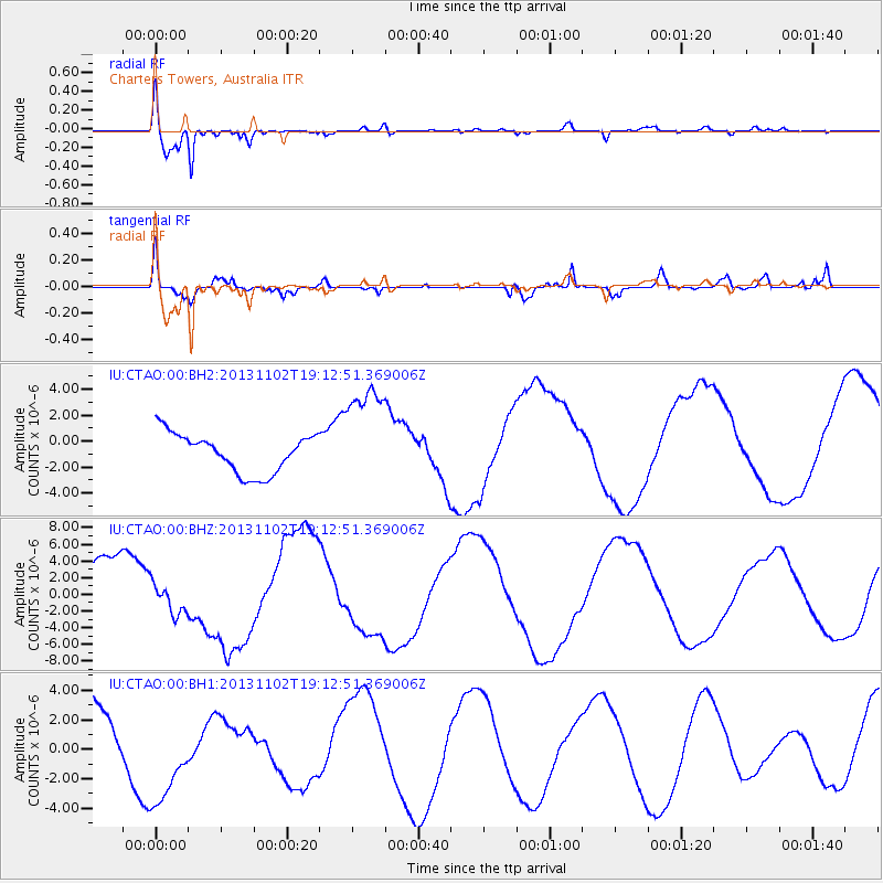
CTAO Charters Towers, Australia - Earthquake Result Viewer
*The percent match for this event was below the threshold and hence no stack was calculated.
| Earthquake location: |
Tonga Islands Region |
| Earthquake latitude/longitude: |
-19.2/-172.4 |
| Earthquake time(UTC): |
2013/11/02 (306) 19:05:56 GMT |
| Earthquake Depth: |
10 km |
| Earthquake Magnitude: |
5.7 MWC, 5.7 MWC |
| Earthquake Catalog/Contributor: |
NEIC PDE/NEIC COMCAT |
|
| Network: |
IU Global Seismograph Network (GSN - IRIS/USGS) |
| Station: |
CTAO Charters Towers, Australia |
| Lat/Lon: |
20.09 S/146.25 E |
| Elevation: |
357 m |
|
| Distance: |
38.9 deg |
| Az: |
261.579 deg |
| Baz: |
95.956 deg |
| Ray Param: |
$rayparam |
*The percent match for this event was below the threshold and hence was not used in the summary stack. |
|
| Radial Match: |
96.018654 % |
| Radial Bump: |
363 |
| Transverse Match: |
25.063047 % |
| Transverse Bump: |
244 |
| SOD ConfigId: |
626651 |
| Insert Time: |
2014-04-19 10:53:55.136 +0000 |
| GWidth: |
2.5 |
| Max Bumps: |
400 |
| Tol: |
0.001 |
|
Signal To Noise
| Channel | StoN | STA | LTA |
| IU:CTAO:00:BHZ:20131102T19:12:51.369006Z | 0.58036155 | 1.7503965E-6 | 3.016045E-6 |
| IU:CTAO:00:BH1:20131102T19:12:51.369006Z | 1.1228696 | 3.13226E-6 | 2.7895137E-6 |
| IU:CTAO:00:BH2:20131102T19:12:51.369006Z | 2.749068 | 4.1490553E-6 | 1.5092588E-6 |
| Arrivals |
| Ps | |
| PpPs | |
| PsPs/PpSs | |


