You are here: Home > Network List > CI - Caltech Regional Seismic Network Stations List
> Station SWS Sam W. Stewart, Westmorland, CA, USA > Earthquake Result Viewer
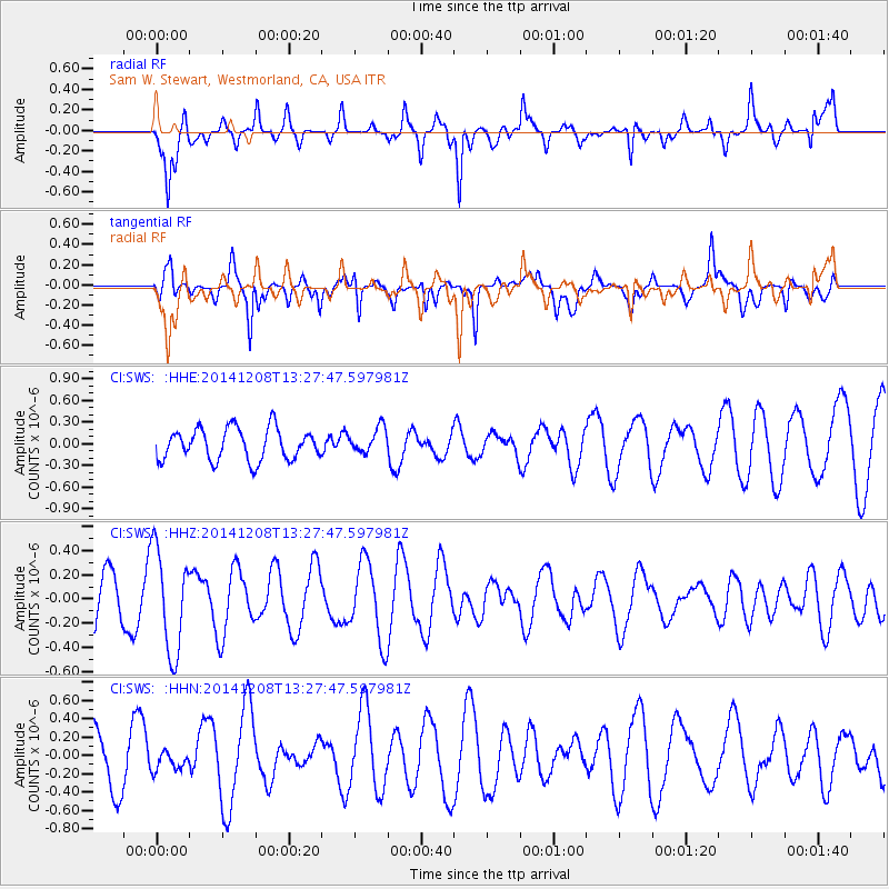
SWS Sam W. Stewart, Westmorland, CA, USA - Earthquake Result Viewer
*The percent match for this event was below the threshold and hence no stack was calculated.
| Earthquake location: |
Solomon Islands |
| Earthquake latitude/longitude: |
-6.5/154.6 |
| Earthquake time(UTC): |
2014/12/08 (342) 13:15:04 GMT |
| Earthquake Depth: |
10 km |
| Earthquake Magnitude: |
5.4 MW, 5.0 mb |
| Earthquake Catalog/Contributor: |
ISC/ISC |
|
| Network: |
CI Caltech Regional Seismic Network |
| Station: |
SWS Sam W. Stewart, Westmorland, CA, USA |
| Lat/Lon: |
32.94 N/115.80 W |
| Elevation: |
140 m |
|
| Distance: |
93.2 deg |
| Az: |
57.369 deg |
| Baz: |
264.361 deg |
| Ray Param: |
$rayparam |
*The percent match for this event was below the threshold and hence was not used in the summary stack. |
|
| Radial Match: |
73.02944 % |
| Radial Bump: |
357 |
| Transverse Match: |
61.056843 % |
| Transverse Bump: |
375 |
| SOD ConfigId: |
3390531 |
| Insert Time: |
2019-04-15 10:59:14.862 +0000 |
| GWidth: |
2.5 |
| Max Bumps: |
400 |
| Tol: |
0.001 |
|
Signal To Noise
| Channel | StoN | STA | LTA |
| CI:SWS: :HHZ:20141208T13:27:47.597981Z | 2.188125 | 4.2161903E-7 | 1.9268509E-7 |
| CI:SWS: :HHN:20141208T13:27:47.597981Z | 0.31440598 | 1.04890944E-7 | 3.3361624E-7 |
| CI:SWS: :HHE:20141208T13:27:47.597981Z | 0.8025431 | 1.751036E-7 | 2.181859E-7 |
| Arrivals |
| Ps | |
| PpPs | |
| PsPs/PpSs | |


