You are here: Home > Network List > BK - Berkeley Digital Seismograph Network Stations List
> Station HUMO Hull Mountain, OR > Earthquake Result Viewer
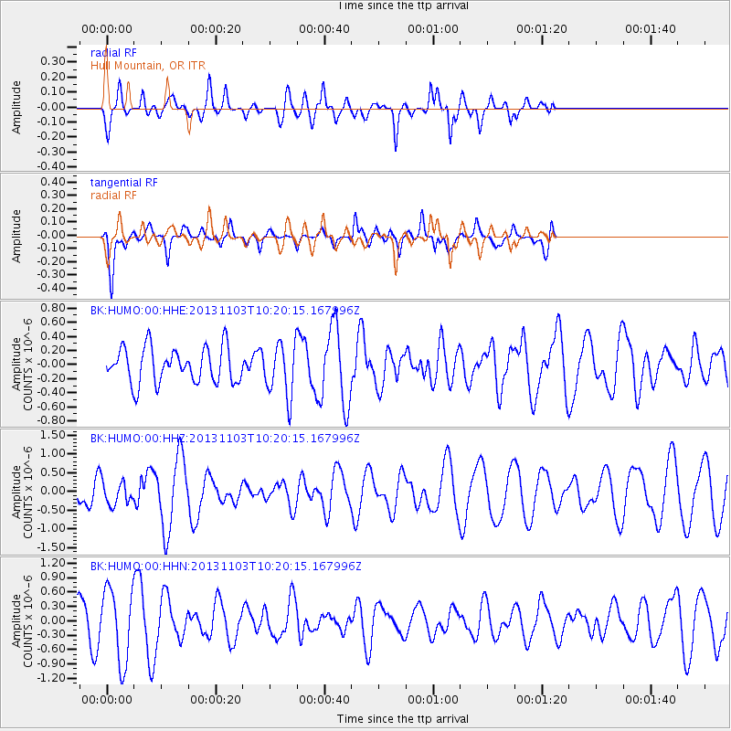
HUMO Hull Mountain, OR - Earthquake Result Viewer
*The percent match for this event was below the threshold and hence no stack was calculated.
| Earthquake location: |
Tonga Islands Region |
| Earthquake latitude/longitude: |
-19.2/-172.5 |
| Earthquake time(UTC): |
2013/11/03 (307) 10:08:54 GMT |
| Earthquake Depth: |
4.0 km |
| Earthquake Magnitude: |
5.6 MWB, 5.5 MWC |
| Earthquake Catalog/Contributor: |
NEIC PDE/NEIC COMCAT |
|
| Network: |
BK Berkeley Digital Seismograph Network |
| Station: |
HUMO Hull Mountain, OR |
| Lat/Lon: |
42.61 N/122.96 W |
| Elevation: |
555 m |
|
| Distance: |
76.6 deg |
| Az: |
35.293 deg |
| Baz: |
227.69 deg |
| Ray Param: |
$rayparam |
*The percent match for this event was below the threshold and hence was not used in the summary stack. |
|
| Radial Match: |
70.64309 % |
| Radial Bump: |
400 |
| Transverse Match: |
64.018906 % |
| Transverse Bump: |
398 |
| SOD ConfigId: |
626651 |
| Insert Time: |
2014-04-19 11:20:18.258 +0000 |
| GWidth: |
2.5 |
| Max Bumps: |
400 |
| Tol: |
0.001 |
|
Signal To Noise
| Channel | StoN | STA | LTA |
| BK:HUMO:00:HHZ:20131103T10:20:15.167996Z | 0.5096004 | 2.9414338E-7 | 5.7720393E-7 |
| BK:HUMO:00:HHN:20131103T10:20:15.167996Z | 2.3164496 | 7.6844026E-7 | 3.317319E-7 |
| BK:HUMO:00:HHE:20131103T10:20:15.167996Z | 1.4953763 | 3.7504097E-7 | 2.5080038E-7 |
| Arrivals |
| Ps | |
| PpPs | |
| PsPs/PpSs | |


