You are here: Home > Network List > IU - Global Seismograph Network (GSN - IRIS/USGS) Stations List
> Station PMG Port Moresby, New Guinea > Earthquake Result Viewer
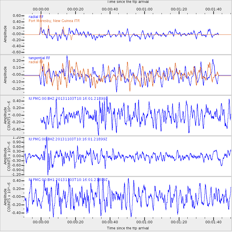
PMG Port Moresby, New Guinea - Earthquake Result Viewer
*The percent match for this event was below the threshold and hence no stack was calculated.
| Earthquake location: |
Tonga Islands Region |
| Earthquake latitude/longitude: |
-19.2/-172.5 |
| Earthquake time(UTC): |
2013/11/03 (307) 10:08:54 GMT |
| Earthquake Depth: |
4.0 km |
| Earthquake Magnitude: |
5.6 MWB, 5.5 MWC |
| Earthquake Catalog/Contributor: |
NEIC PDE/NEIC COMCAT |
|
| Network: |
IU Global Seismograph Network (GSN - IRIS/USGS) |
| Station: |
PMG Port Moresby, New Guinea |
| Lat/Lon: |
9.40 S/147.16 E |
| Elevation: |
90 m |
|
| Distance: |
40.2 deg |
| Az: |
278.267 deg |
| Baz: |
108.606 deg |
| Ray Param: |
$rayparam |
*The percent match for this event was below the threshold and hence was not used in the summary stack. |
|
| Radial Match: |
49.68201 % |
| Radial Bump: |
400 |
| Transverse Match: |
58.761444 % |
| Transverse Bump: |
400 |
| SOD ConfigId: |
626651 |
| Insert Time: |
2014-04-19 11:24:42.027 +0000 |
| GWidth: |
2.5 |
| Max Bumps: |
400 |
| Tol: |
0.001 |
|
Signal To Noise
| Channel | StoN | STA | LTA |
| IU:PMG:00:BHZ:20131103T10:16:01.21899Z | 3.3950098 | 5.160985E-7 | 1.5201681E-7 |
| IU:PMG:00:BH1:20131103T10:16:01.21899Z | 0.9900212 | 1.841502E-7 | 1.8600632E-7 |
| IU:PMG:00:BH2:20131103T10:16:01.21899Z | 1.3479425 | 2.1143741E-7 | 1.5685937E-7 |
| Arrivals |
| Ps | |
| PpPs | |
| PsPs/PpSs | |


