You are here: Home > Network List > TA - USArray Transportable Network (new EarthScope stations) Stations List
> Station ABTX Abilene, Hawley, TX, USA > Earthquake Result Viewer
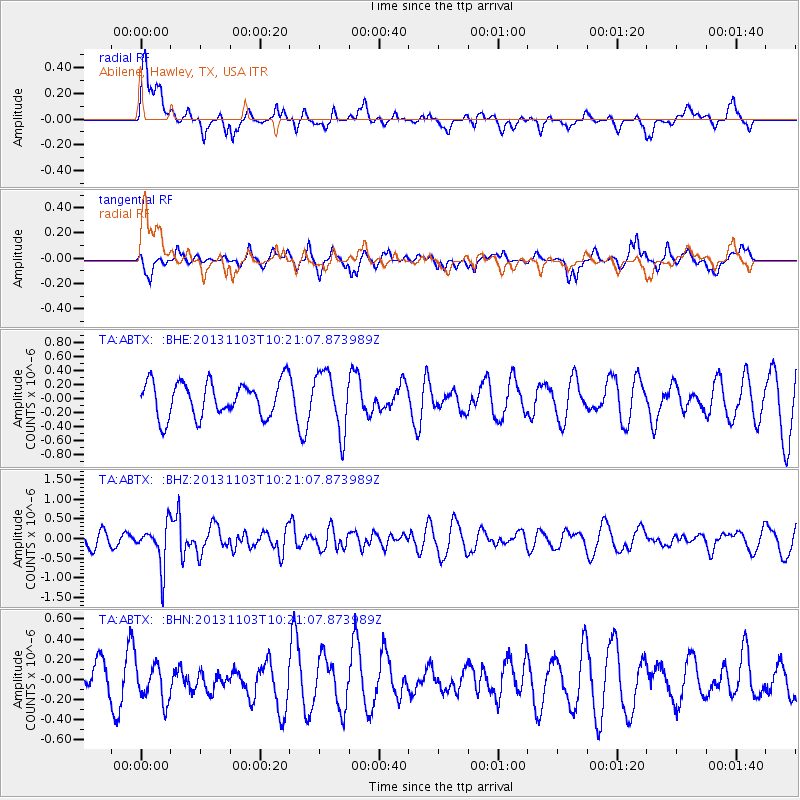
ABTX Abilene, Hawley, TX, USA - Earthquake Result Viewer
*The percent match for this event was below the threshold and hence no stack was calculated.
| Earthquake location: |
Tonga Islands Region |
| Earthquake latitude/longitude: |
-19.2/-172.5 |
| Earthquake time(UTC): |
2013/11/03 (307) 10:08:54 GMT |
| Earthquake Depth: |
4.0 km |
| Earthquake Magnitude: |
5.6 MWB, 5.5 MWC |
| Earthquake Catalog/Contributor: |
NEIC PDE/NEIC COMCAT |
|
| Network: |
TA USArray Transportable Network (new EarthScope stations) |
| Station: |
ABTX Abilene, Hawley, TX, USA |
| Lat/Lon: |
32.62 N/99.64 W |
| Elevation: |
502 m |
|
| Distance: |
86.6 deg |
| Az: |
53.894 deg |
| Baz: |
244.788 deg |
| Ray Param: |
$rayparam |
*The percent match for this event was below the threshold and hence was not used in the summary stack. |
|
| Radial Match: |
55.639233 % |
| Radial Bump: |
400 |
| Transverse Match: |
43.475975 % |
| Transverse Bump: |
353 |
| SOD ConfigId: |
626651 |
| Insert Time: |
2014-04-19 11:29:03.599 +0000 |
| GWidth: |
2.5 |
| Max Bumps: |
400 |
| Tol: |
0.001 |
|
Signal To Noise
| Channel | StoN | STA | LTA |
| TA:ABTX: :BHZ:20131103T10:21:07.873989Z | 2.618518 | 5.35445E-7 | 2.0448397E-7 |
| TA:ABTX: :BHN:20131103T10:21:07.873989Z | 1.1087785 | 1.8521447E-7 | 1.6704372E-7 |
| TA:ABTX: :BHE:20131103T10:21:07.873989Z | 1.6835319 | 4.1820184E-7 | 2.4840742E-7 |
| Arrivals |
| Ps | |
| PpPs | |
| PsPs/PpSs | |


