You are here: Home > Network List > TA - USArray Transportable Network (new EarthScope stations) Stations List
> Station HDA Harding Lake, AK, USA > Earthquake Result Viewer
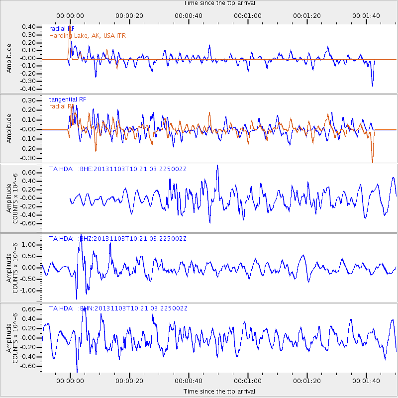
HDA Harding Lake, AK, USA - Earthquake Result Viewer
*The percent match for this event was below the threshold and hence no stack was calculated.
| Earthquake location: |
Tonga Islands Region |
| Earthquake latitude/longitude: |
-19.2/-172.5 |
| Earthquake time(UTC): |
2013/11/03 (307) 10:08:54 GMT |
| Earthquake Depth: |
4.0 km |
| Earthquake Magnitude: |
5.6 MWB, 5.5 MWC |
| Earthquake Catalog/Contributor: |
NEIC PDE/NEIC COMCAT |
|
| Network: |
TA USArray Transportable Network (new EarthScope stations) |
| Station: |
HDA Harding Lake, AK, USA |
| Lat/Lon: |
64.41 N/146.95 W |
| Elevation: |
437 m |
|
| Distance: |
85.7 deg |
| Az: |
10.841 deg |
| Baz: |
204.158 deg |
| Ray Param: |
$rayparam |
*The percent match for this event was below the threshold and hence was not used in the summary stack. |
|
| Radial Match: |
49.645386 % |
| Radial Bump: |
400 |
| Transverse Match: |
59.98441 % |
| Transverse Bump: |
400 |
| SOD ConfigId: |
626651 |
| Insert Time: |
2014-04-19 11:29:27.053 +0000 |
| GWidth: |
2.5 |
| Max Bumps: |
400 |
| Tol: |
0.001 |
|
Signal To Noise
| Channel | StoN | STA | LTA |
| TA:HDA: :BHZ:20131103T10:21:03.225002Z | 5.4227476 | 6.61687E-7 | 1.2202062E-7 |
| TA:HDA: :BHN:20131103T10:21:03.225002Z | 1.1806797 | 3.1738617E-7 | 2.688165E-7 |
| TA:HDA: :BHE:20131103T10:21:03.225002Z | 1.7813889 | 1.9765933E-7 | 1.10957984E-7 |
| Arrivals |
| Ps | |
| PpPs | |
| PsPs/PpSs | |


