You are here: Home > Network List > II - Global Seismograph Network (GSN - IRIS/IDA) Stations List
> Station KAPI Kappang, Sulawesi, Indonesia > Earthquake Result Viewer
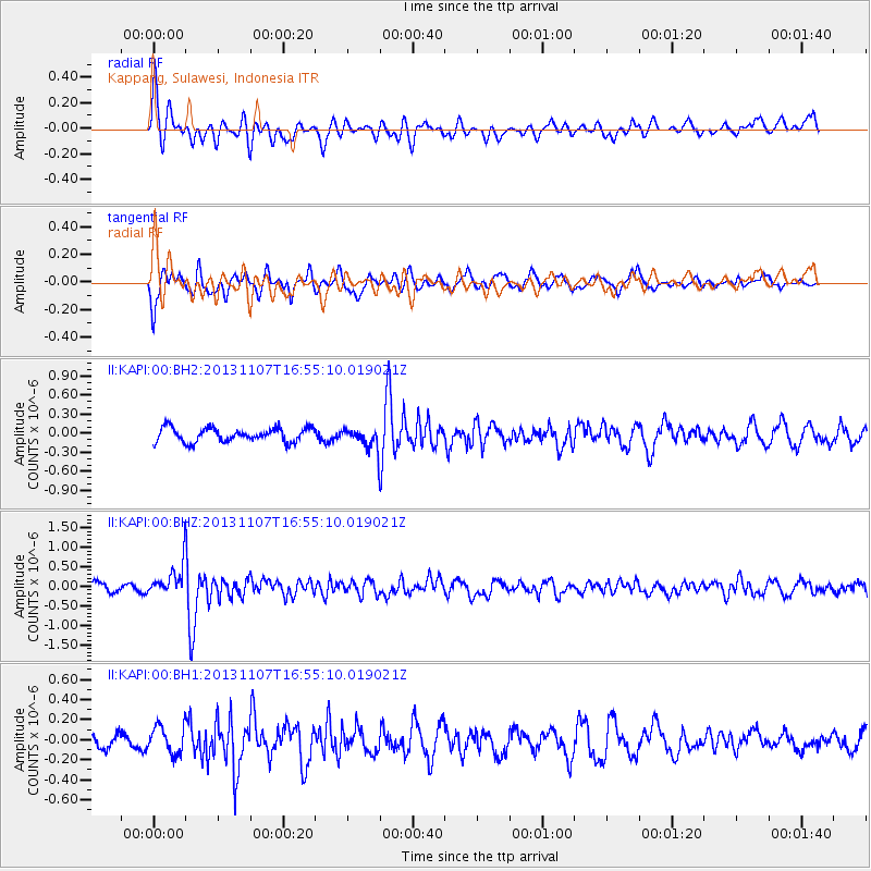
KAPI Kappang, Sulawesi, Indonesia - Earthquake Result Viewer
*The percent match for this event was below the threshold and hence no stack was calculated.
| Earthquake location: |
Southeast Of Loyalty Islands |
| Earthquake latitude/longitude: |
-22.3/171.5 |
| Earthquake time(UTC): |
2013/11/07 (311) 16:46:34 GMT |
| Earthquake Depth: |
98 km |
| Earthquake Magnitude: |
5.7 MWW, 5.7 MWB, 5.8 MWC |
| Earthquake Catalog/Contributor: |
NEIC PDE/NEIC COMCAT |
|
| Network: |
II Global Seismograph Network (GSN - IRIS/IDA) |
| Station: |
KAPI Kappang, Sulawesi, Indonesia |
| Lat/Lon: |
5.01 S/119.75 E |
| Elevation: |
300 m |
|
| Distance: |
52.9 deg |
| Az: |
281.011 deg |
| Baz: |
114.169 deg |
| Ray Param: |
$rayparam |
*The percent match for this event was below the threshold and hence was not used in the summary stack. |
|
| Radial Match: |
73.43925 % |
| Radial Bump: |
400 |
| Transverse Match: |
60.76271 % |
| Transverse Bump: |
400 |
| SOD ConfigId: |
626651 |
| Insert Time: |
2014-04-19 11:56:42.203 +0000 |
| GWidth: |
2.5 |
| Max Bumps: |
400 |
| Tol: |
0.001 |
|
Signal To Noise
| Channel | StoN | STA | LTA |
| II:KAPI:00:BHZ:20131107T16:55:10.019021Z | 2.8075616 | 3.9237742E-7 | 1.3975738E-7 |
| II:KAPI:00:BH1:20131107T16:55:10.019021Z | 1.4721082 | 1.3872767E-7 | 9.423741E-8 |
| II:KAPI:00:BH2:20131107T16:55:10.019021Z | 1.4969084 | 1.637403E-7 | 1.09385645E-7 |
| Arrivals |
| Ps | |
| PpPs | |
| PsPs/PpSs | |


