You are here: Home > Network List > TA - USArray Transportable Network (new EarthScope stations) Stations List
> Station C06D Leavenworth, WQ, USA > Earthquake Result Viewer
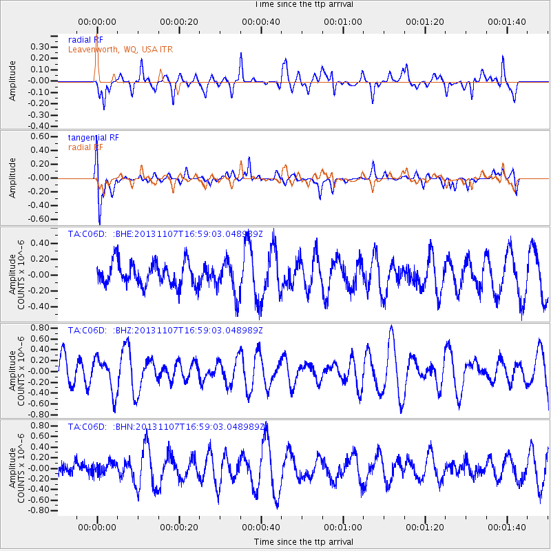
C06D Leavenworth, WQ, USA - Earthquake Result Viewer
*The percent match for this event was below the threshold and hence no stack was calculated.
| Earthquake location: |
Southeast Of Loyalty Islands |
| Earthquake latitude/longitude: |
-22.3/171.5 |
| Earthquake time(UTC): |
2013/11/07 (311) 16:46:34 GMT |
| Earthquake Depth: |
98 km |
| Earthquake Magnitude: |
5.7 MWW, 5.7 MWB, 5.8 MWC |
| Earthquake Catalog/Contributor: |
NEIC PDE/NEIC COMCAT |
|
| Network: |
TA USArray Transportable Network (new EarthScope stations) |
| Station: |
C06D Leavenworth, WQ, USA |
| Lat/Lon: |
47.92 N/120.89 W |
| Elevation: |
544 m |
|
| Distance: |
92.4 deg |
| Az: |
38.479 deg |
| Baz: |
238.935 deg |
| Ray Param: |
$rayparam |
*The percent match for this event was below the threshold and hence was not used in the summary stack. |
|
| Radial Match: |
52.02492 % |
| Radial Bump: |
360 |
| Transverse Match: |
50.820587 % |
| Transverse Bump: |
400 |
| SOD ConfigId: |
626651 |
| Insert Time: |
2014-04-19 12:00:04.266 +0000 |
| GWidth: |
2.5 |
| Max Bumps: |
400 |
| Tol: |
0.001 |
|
Signal To Noise
| Channel | StoN | STA | LTA |
| TA:C06D: :BHZ:20131107T16:59:03.048989Z | 1.217126 | 3.195756E-7 | 2.6256572E-7 |
| TA:C06D: :BHN:20131107T16:59:03.048989Z | 0.4815919 | 1.2898695E-7 | 2.6783457E-7 |
| TA:C06D: :BHE:20131107T16:59:03.048989Z | 1.5143209 | 2.1996722E-7 | 1.4525801E-7 |
| Arrivals |
| Ps | |
| PpPs | |
| PsPs/PpSs | |


