You are here: Home > Network List > TA - USArray Transportable Network (new EarthScope stations) Stations List
> Station M04C Macdoel, CA, USA > Earthquake Result Viewer
M04C Macdoel, CA, USA - Earthquake Result Viewer
*The percent match for this event was below the threshold and hence no stack was calculated.
| Earthquake location: |
Southeast Of Loyalty Islands |
| Earthquake latitude/longitude: |
-22.3/171.5 |
| Earthquake time(UTC): |
2013/11/07 (311) 16:46:34 GMT |
| Earthquake Depth: |
98 km |
| Earthquake Magnitude: |
5.7 MWW, 5.7 MWB, 5.8 MWC |
| Earthquake Catalog/Contributor: |
NEIC PDE/NEIC COMCAT |
|
| Network: |
TA USArray Transportable Network (new EarthScope stations) |
| Station: |
M04C Macdoel, CA, USA |
| Lat/Lon: |
41.78 N/121.84 W |
| Elevation: |
1391 m |
|
| Distance: |
88.6 deg |
| Az: |
43.367 deg |
| Baz: |
238.227 deg |
| Ray Param: |
$rayparam |
*The percent match for this event was below the threshold and hence was not used in the summary stack. |
|
| Radial Match: |
71.49609 % |
| Radial Bump: |
376 |
| Transverse Match: |
50.314247 % |
| Transverse Bump: |
400 |
| SOD ConfigId: |
626651 |
| Insert Time: |
2014-04-19 12:00:35.695 +0000 |
| GWidth: |
2.5 |
| Max Bumps: |
400 |
| Tol: |
0.001 |
|
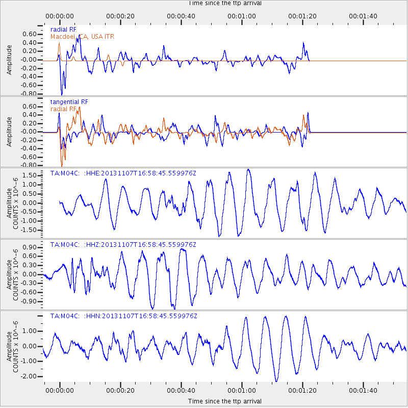
Signal To Noise
| Channel | StoN | STA | LTA |
| TA:M04C: :HHZ:20131107T16:58:45.559976Z | 0.78919643 | 3.527853E-7 | 4.4701835E-7 |
| TA:M04C: :HHN:20131107T16:58:45.559976Z | 0.54281527 | 4.1088379E-7 | 7.569496E-7 |
| TA:M04C: :HHE:20131107T16:58:45.559976Z | 1.0249757 | 6.065853E-7 | 5.9180456E-7 |
| Arrivals |
| Ps | |
| PpPs | |
| PsPs/PpSs | |


