You are here: Home > Network List > II - Global Seismograph Network (GSN - IRIS/IDA) Stations List
> Station WRAB Tennant Creek, NT, Australia > Earthquake Result Viewer
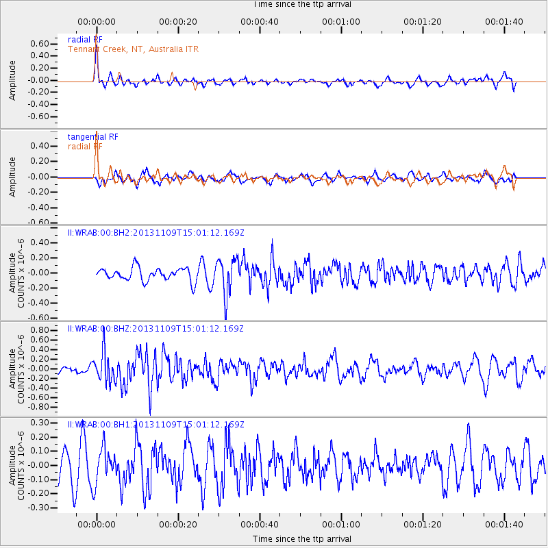
WRAB Tennant Creek, NT, Australia - Earthquake Result Viewer
*The percent match for this event was below the threshold and hence no stack was calculated.
| Earthquake location: |
Kermadec Islands Region |
| Earthquake latitude/longitude: |
-28.3/-176.8 |
| Earthquake time(UTC): |
2013/11/09 (313) 14:53:26 GMT |
| Earthquake Depth: |
10 km |
| Earthquake Magnitude: |
5.5 MWB, 5.5 MWC |
| Earthquake Catalog/Contributor: |
NEIC PDE/NEIC COMCAT |
|
| Network: |
II Global Seismograph Network (GSN - IRIS/IDA) |
| Station: |
WRAB Tennant Creek, NT, Australia |
| Lat/Lon: |
19.93 S/134.36 E |
| Elevation: |
366 m |
|
| Distance: |
45.1 deg |
| Az: |
269.453 deg |
| Baz: |
110.434 deg |
| Ray Param: |
$rayparam |
*The percent match for this event was below the threshold and hence was not used in the summary stack. |
|
| Radial Match: |
64.85876 % |
| Radial Bump: |
400 |
| Transverse Match: |
42.951054 % |
| Transverse Bump: |
400 |
| SOD ConfigId: |
626651 |
| Insert Time: |
2014-04-19 12:34:56.806 +0000 |
| GWidth: |
2.5 |
| Max Bumps: |
400 |
| Tol: |
0.001 |
|
Signal To Noise
| Channel | StoN | STA | LTA |
| II:WRAB:00:BHZ:20131109T15:01:12.169Z | 3.9247 | 3.1876976E-7 | 8.122143E-8 |
| II:WRAB:00:BH1:20131109T15:01:12.169Z | 0.953612 | 1.2407023E-7 | 1.3010556E-7 |
| II:WRAB:00:BH2:20131109T15:01:12.169Z | 2.7876813 | 2.4084852E-7 | 8.6397435E-8 |
| Arrivals |
| Ps | |
| PpPs | |
| PsPs/PpSs | |


