You are here: Home > Network List > TA - USArray Transportable Network (new EarthScope stations) Stations List
> Station R11A Troy Canyon, Currant, NV, USA > Earthquake Result Viewer
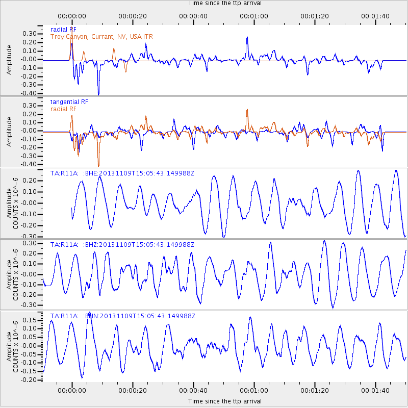
R11A Troy Canyon, Currant, NV, USA - Earthquake Result Viewer
*The percent match for this event was below the threshold and hence no stack was calculated.
| Earthquake location: |
Kermadec Islands Region |
| Earthquake latitude/longitude: |
-28.3/-176.8 |
| Earthquake time(UTC): |
2013/11/09 (313) 14:53:26 GMT |
| Earthquake Depth: |
10 km |
| Earthquake Magnitude: |
5.5 MWB, 5.5 MWC |
| Earthquake Catalog/Contributor: |
NEIC PDE/NEIC COMCAT |
|
| Network: |
TA USArray Transportable Network (new EarthScope stations) |
| Station: |
R11A Troy Canyon, Currant, NV, USA |
| Lat/Lon: |
38.35 N/115.59 W |
| Elevation: |
1756 m |
|
| Distance: |
87.6 deg |
| Az: |
43.595 deg |
| Baz: |
230.643 deg |
| Ray Param: |
$rayparam |
*The percent match for this event was below the threshold and hence was not used in the summary stack. |
|
| Radial Match: |
59.248085 % |
| Radial Bump: |
373 |
| Transverse Match: |
31.50973 % |
| Transverse Bump: |
317 |
| SOD ConfigId: |
626651 |
| Insert Time: |
2014-04-19 12:39:01.745 +0000 |
| GWidth: |
2.5 |
| Max Bumps: |
400 |
| Tol: |
0.001 |
|
Signal To Noise
| Channel | StoN | STA | LTA |
| TA:R11A: :BHZ:20131109T15:05:43.149988Z | 1.5072651 | 1.3797815E-7 | 9.1542056E-8 |
| TA:R11A: :BHN:20131109T15:05:43.149988Z | 1.3335375 | 1.2113587E-7 | 9.083799E-8 |
| TA:R11A: :BHE:20131109T15:05:43.149988Z | 0.64834785 | 8.202516E-8 | 1.2651412E-7 |
| Arrivals |
| Ps | |
| PpPs | |
| PsPs/PpSs | |


