You are here: Home > Network List > US - United States National Seismic Network Stations List
> Station ELK Elko, Nevada, USA > Earthquake Result Viewer
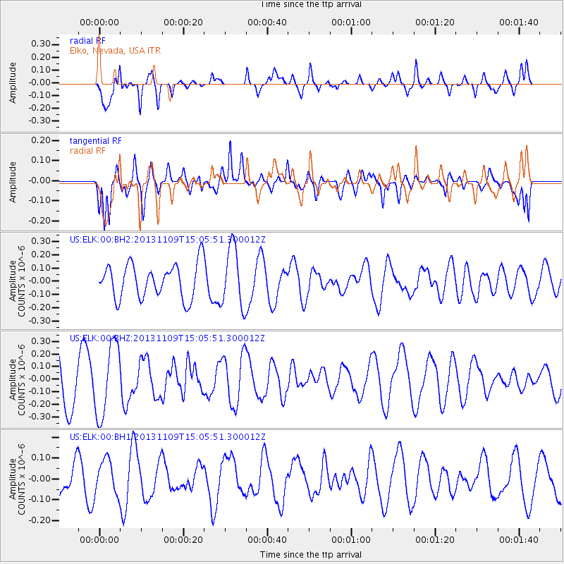
ELK Elko, Nevada, USA - Earthquake Result Viewer
*The percent match for this event was below the threshold and hence no stack was calculated.
| Earthquake location: |
Kermadec Islands Region |
| Earthquake latitude/longitude: |
-28.3/-176.8 |
| Earthquake time(UTC): |
2013/11/09 (313) 14:53:26 GMT |
| Earthquake Depth: |
10 km |
| Earthquake Magnitude: |
5.5 MWB, 5.5 MWC |
| Earthquake Catalog/Contributor: |
NEIC PDE/NEIC COMCAT |
|
| Network: |
US United States National Seismic Network |
| Station: |
ELK Elko, Nevada, USA |
| Lat/Lon: |
40.74 N/115.24 W |
| Elevation: |
2210 m |
|
| Distance: |
89.3 deg |
| Az: |
41.912 deg |
| Baz: |
230.817 deg |
| Ray Param: |
$rayparam |
*The percent match for this event was below the threshold and hence was not used in the summary stack. |
|
| Radial Match: |
71.17643 % |
| Radial Bump: |
400 |
| Transverse Match: |
50.656723 % |
| Transverse Bump: |
400 |
| SOD ConfigId: |
626651 |
| Insert Time: |
2014-04-19 12:39:32.396 +0000 |
| GWidth: |
2.5 |
| Max Bumps: |
400 |
| Tol: |
0.001 |
|
Signal To Noise
| Channel | StoN | STA | LTA |
| US:ELK:00:BHZ:20131109T15:05:51.300012Z | 1.9853166 | 2.933065E-7 | 1.4773791E-7 |
| US:ELK:00:BH1:20131109T15:05:51.300012Z | 0.8614935 | 8.252811E-8 | 9.579656E-8 |
| US:ELK:00:BH2:20131109T15:05:51.300012Z | 1.7742249 | 2.288329E-7 | 1.2897627E-7 |
| Arrivals |
| Ps | |
| PpPs | |
| PsPs/PpSs | |


