You are here: Home > Network List > US - United States National Seismic Network Stations List
> Station LAO LASA Array, Montana, USA > Earthquake Result Viewer
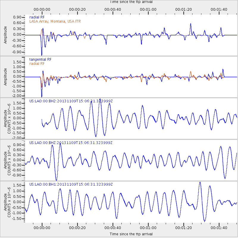
LAO LASA Array, Montana, USA - Earthquake Result Viewer
*The percent match for this event was below the threshold and hence no stack was calculated.
| Earthquake location: |
Kermadec Islands Region |
| Earthquake latitude/longitude: |
-28.3/-176.8 |
| Earthquake time(UTC): |
2013/11/09 (313) 14:53:26 GMT |
| Earthquake Depth: |
10 km |
| Earthquake Magnitude: |
5.5 MWB, 5.5 MWC |
| Earthquake Catalog/Contributor: |
NEIC PDE/NEIC COMCAT |
|
| Network: |
US United States National Seismic Network |
| Station: |
LAO LASA Array, Montana, USA |
| Lat/Lon: |
46.69 N/106.22 W |
| Elevation: |
902 m |
|
| Distance: |
98.1 deg |
| Az: |
40.964 deg |
| Baz: |
237.102 deg |
| Ray Param: |
$rayparam |
*The percent match for this event was below the threshold and hence was not used in the summary stack. |
|
| Radial Match: |
47.72038 % |
| Radial Bump: |
400 |
| Transverse Match: |
51.556343 % |
| Transverse Bump: |
400 |
| SOD ConfigId: |
626651 |
| Insert Time: |
2014-04-19 12:39:39.279 +0000 |
| GWidth: |
2.5 |
| Max Bumps: |
400 |
| Tol: |
0.001 |
|
Signal To Noise
| Channel | StoN | STA | LTA |
| US:LAO:00:BHZ:20131109T15:06:31.323999Z | 0.8421849 | 1.8845913E-7 | 2.2377405E-7 |
| US:LAO:00:BH1:20131109T15:06:31.323999Z | 1.2163779 | 6.106513E-7 | 5.020243E-7 |
| US:LAO:00:BH2:20131109T15:06:31.323999Z | 1.8999965 | 1.2722857E-6 | 6.6962525E-7 |
| Arrivals |
| Ps | |
| PpPs | |
| PsPs/PpSs | |


