You are here: Home > Network List > TA - USArray Transportable Network (new EarthScope stations) Stations List
> Station L56A Greenwood, NY, USA > Earthquake Result Viewer
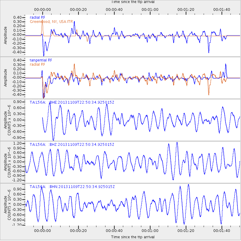
L56A Greenwood, NY, USA - Earthquake Result Viewer
*The percent match for this event was below the threshold and hence no stack was calculated.
| Earthquake location: |
Near S. Coast Of Honshu, Japan |
| Earthquake latitude/longitude: |
35.9/140.0 |
| Earthquake time(UTC): |
2013/11/09 (313) 22:37:50 GMT |
| Earthquake Depth: |
64 km |
| Earthquake Magnitude: |
5.6 MWW, 5.5 MWR, 5.6 MWW, 5.6 MWB, 5.7 MWC |
| Earthquake Catalog/Contributor: |
NEIC PDE/NEIC COMCAT |
|
| Network: |
TA USArray Transportable Network (new EarthScope stations) |
| Station: |
L56A Greenwood, NY, USA |
| Lat/Lon: |
42.14 N/77.56 W |
| Elevation: |
688 m |
|
| Distance: |
95.1 deg |
| Az: |
27.055 deg |
| Baz: |
330.238 deg |
| Ray Param: |
$rayparam |
*The percent match for this event was below the threshold and hence was not used in the summary stack. |
|
| Radial Match: |
51.98606 % |
| Radial Bump: |
354 |
| Transverse Match: |
76.01295 % |
| Transverse Bump: |
400 |
| SOD ConfigId: |
626651 |
| Insert Time: |
2014-04-19 13:02:38.821 +0000 |
| GWidth: |
2.5 |
| Max Bumps: |
400 |
| Tol: |
0.001 |
|
Signal To Noise
| Channel | StoN | STA | LTA |
| TA:L56A: :BHZ:20131109T22:50:34.925015Z | 1.4016308 | 5.716123E-7 | 4.0781944E-7 |
| TA:L56A: :BHN:20131109T22:50:34.925015Z | 1.8474696 | 7.318207E-7 | 3.9612058E-7 |
| TA:L56A: :BHE:20131109T22:50:34.925015Z | 1.0903393 | 4.82781E-7 | 4.4278048E-7 |
| Arrivals |
| Ps | |
| PpPs | |
| PsPs/PpSs | |


