You are here: Home > Network List > TA - USArray Transportable Network (new EarthScope stations) Stations List
> Station U51A La Follette, TN, USA > Earthquake Result Viewer
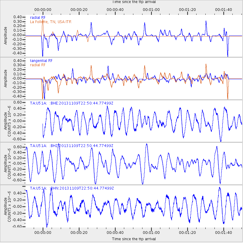
U51A La Follette, TN, USA - Earthquake Result Viewer
*The percent match for this event was below the threshold and hence no stack was calculated.
| Earthquake location: |
Near S. Coast Of Honshu, Japan |
| Earthquake latitude/longitude: |
35.9/140.0 |
| Earthquake time(UTC): |
2013/11/09 (313) 22:37:50 GMT |
| Earthquake Depth: |
64 km |
| Earthquake Magnitude: |
5.6 MWW, 5.5 MWR, 5.6 MWW, 5.6 MWB, 5.7 MWC |
| Earthquake Catalog/Contributor: |
NEIC PDE/NEIC COMCAT |
|
| Network: |
TA USArray Transportable Network (new EarthScope stations) |
| Station: |
U51A La Follette, TN, USA |
| Lat/Lon: |
36.38 N/84.02 W |
| Elevation: |
472 m |
|
| Distance: |
97.3 deg |
| Az: |
34.401 deg |
| Baz: |
325.37 deg |
| Ray Param: |
$rayparam |
*The percent match for this event was below the threshold and hence was not used in the summary stack. |
|
| Radial Match: |
38.549904 % |
| Radial Bump: |
400 |
| Transverse Match: |
63.28215 % |
| Transverse Bump: |
400 |
| SOD ConfigId: |
626651 |
| Insert Time: |
2014-04-19 13:05:13.833 +0000 |
| GWidth: |
2.5 |
| Max Bumps: |
400 |
| Tol: |
0.001 |
|
Signal To Noise
| Channel | StoN | STA | LTA |
| TA:U51A: :BHZ:20131109T22:50:44.77499Z | 0.96076083 | 2.6882836E-7 | 2.7980778E-7 |
| TA:U51A: :BHN:20131109T22:50:44.77499Z | 1.8205203 | 3.7851825E-7 | 2.0791764E-7 |
| TA:U51A: :BHE:20131109T22:50:44.77499Z | 0.84195507 | 2.0576577E-7 | 2.4439046E-7 |
| Arrivals |
| Ps | |
| PpPs | |
| PsPs/PpSs | |


