TLY Talaya, Russia - Earthquake Result Viewer
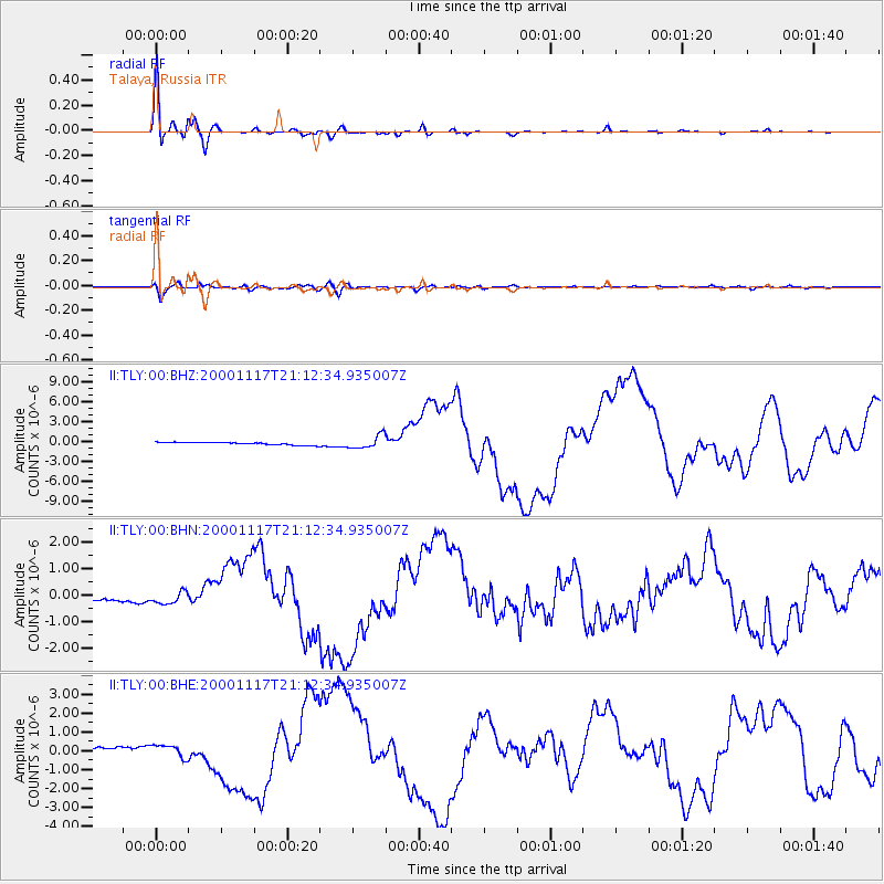
Earthquake location: New Britain Region, P.N.G.
Earthquake latitude/longitude: -5.5/151.8
Earthquake time(UTC): 2000/11/17 (322) 21:01:56 GMT
Earthquake Depth: 33 km
Earthquake Magnitude: 6.2 MB, 8.0 MS, 7.6 MW, 6.9 ME
Earthquake Catalog/Contributor: WHDF/NEIC
Network: II Global Seismograph Network (GSN - IRIS/IDA)
Station: TLY Talaya, Russia
Lat/Lon: 51.68 N/103.64 E
Elevation: 579 m
Distance: 70.2 deg
Az: 330.469 deg
Baz: 127.994 deg
Ray Param: 0.05510761
Estimated Moho Depth: 12.25 km
Estimated Crust Vp/Vs: 2.05
Assumed Crust Vp: 6.419 km/s
Estimated Crust Vs: 3.139 km/s
Estimated Crust Poisson's Ratio: 0.34
Radial Match: 97.397484 %
Radial Bump: 301
Transverse Match: 85.55075 %
Transverse Bump: 400
SOD ConfigId: 3744
Insert Time: 2010-03-01 17:48:18.133 +0000
GWidth: 2.5
Max Bumps: 400
Tol: 0.001

Signal To Noise

ChannelStoNSTALTA
II:TLY:00:BHN:20001117T21:12:34.935007Z3.08737372.1843054E-77.074963E-8
II:TLY:00:BHE:20001117T21:12:34.935007Z3.3734583.2850403E-79.737902E-8
II:TLY:00:BHZ:20001117T21:12:34.935007Z4.648149.674887E-72.0814537E-7
Arrivals
Ps2.1 SECOND
PpPs5.6 SECOND
PsPs/PpSs7.7 SECOND